It's Hot and Getting Hotter—What Does That Mean for Hurricane Season?

Longing for cooler temperatures and rain?
Aren't we all?
Last month set heat records—and that's not hyperbole. Until this year, the warmest May on record was 2019, when the average temperature was 80.7 degrees Fahrenheit. This year, that record was smashed—the average temperature was 81.4 degrees, marking the warmest May in our local recorded history. For comparison, the average monthly temperature for May is 77.8 degrees. That 3.6 degrees above normal is literally off the charts.
Record-high temperatures occur more frequently with dry conditions. Just .02 inches of rain—that's almost nothing—also made this May the third driest in local history.

Image: Courtesy Photo
When looking at temperatures, here's a good visual, which allows you to see daily temperature ranges and record temperatures when they occur. The brown shaded area are the normal ranges in the chart below. The red shaded area shows abnormally hot temperatures, and the blue bars are the daily ranges. At the end of the month, we experienced three-record hot days. In fact, on May 30, the 99 degree Fahrenheit high temperature tied the all-time hottest temperature ever recorded in May in Sarasota.

Image: NOAA
Now, what about the lack of rain? Think about it: Hurricane Ian created the largest inland flood in at least 500 years in our area late in September of 2022. During that historic event, up to 24 inches of rain drenched the center portion of our state. Then, in 2023, Sarasota experienced a severe drought with annual rainfall 23 inches below normal. Although last winter was on the wet side, recent dryness has again pushed the middle and most of the southern portion of Florida into drought conditions.

Image: Courtesy Photo
Let’s talk about the near future.
As is frequently the case, when a trend ends, it can end with a bang. That is exactly what the CAC's annual hurricane season forecast detailed during our Hurricane Day event on April 4.
Since our forecast, two other world-renowned groups with deep experience in hurricane forecasts have issued predictions that confirm ours, including NOAA and Colorado State University.
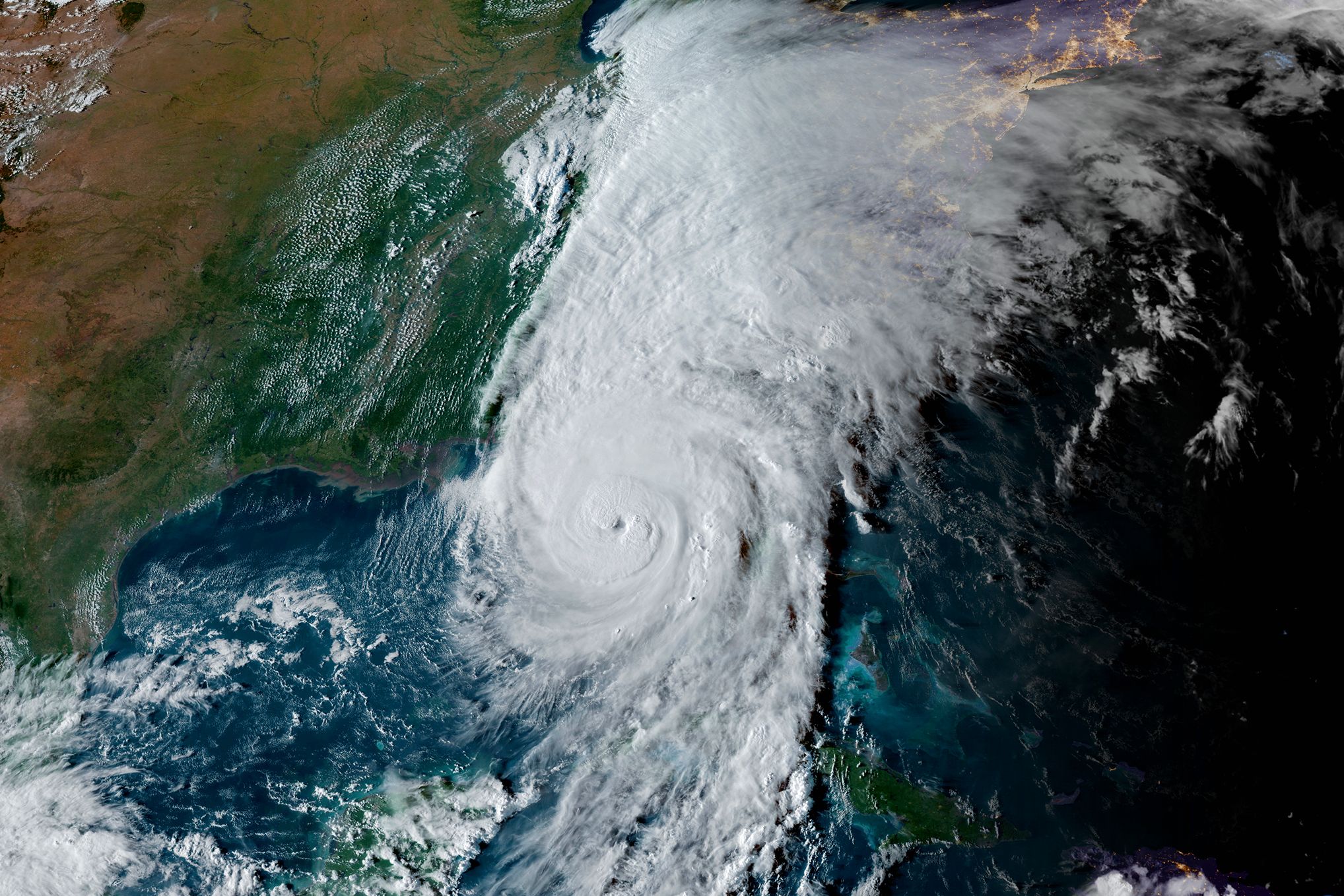
Of concern this season is the combination of record sea surface temperatures, low wind shear and deep mid-level moisture in the Hurricane Formation Area that impacts Florida. That's why the CAC is forecasting double the average of major hurricanes (category 3 or higher, with 111 mph winds or more) and 80 percent more hurricanes this season than is normal even in our climate-warmed world.
Hurricane season is now underway. Although it has been quiet so far, much more active conditions look to be evolving as early as next week. That's why we are shifting from near record dryness this spring to a wet environment in June and into the heart of hurricane season (July through October).

Image: Courtesy Photo
I expect to see a storm named Alberto as early as next week. A concerning pattern is already taking shape in the South Caribbean Sea and it may spit out the first named storm next week. The Gulf of Mexico is the storm's target area, and its associated rain bands could bring much-needed precipitation then. Details will evolve over the coming days.
No matter what, it's time to prepare and be ready for what looks to be a very active hurricane season. We don’t know for sure what it means for Florida and the Suncoast specifically, but more rain is one good bet.
By the way, sea levels since 2010 have risen at a very fast rate. Back in the last half of the 20th century, sea levels were rising at about an inch a decade. Since 2010, our area has experienced 5 inches of sea level rise. The map below details the latest data during that period. As we have seen on the Suncoast, it does not take a major hurricane to create major flooding in our metropolitan area. Storms Eta (November 2020), Idalia (August 2023) and a regular storm last December created 3- to 5-foot storm surges that flooded portions of our barrier islands. As sea levels rise, so too will storm surge flooding events. Minor tropical storms and Category 1 and 2 hurricanes are bigger threats now because of sea level rise.
Bob Bunting is a scientist, entrepreneur and educator and the CEO of the nation’s first Climate Adaptation Center (CAC), headquartered in Sarasota. The Climate Adaptation Center is an expert resource to inform government, academe, the private sector and philanthropy so they can create the necessary adaptation strategies and actions to protect the Florida way of life and foster the climate economy while larger global solutions evolve to solve the climate problem. Contact Bob at [email protected] for more information.