Hurricane Idalia Is Rapidly Intensifying
Hurricane Idalia is rapidly intensifying and is likely to become a Category 3 storm in the next day or so as it steams toward Florida's Big Bend area, with landfall tomorrow morning.
A storm surge warning, tropical storm warning and hurricane watch are in effect for Sarasota. A hurricane warning is also posted for coastal Manatee County.
Are you ready? Storms that begin with the letter "I" have not been good to Florida!
The path of Idalia is becoming more reliable now—but a small eastern shift of the center of the storm could bring much more severe impacts to the mid-Florida Coast, from Tampa Bay to Venice.
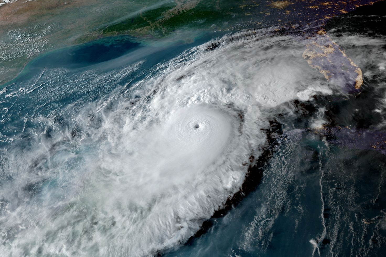
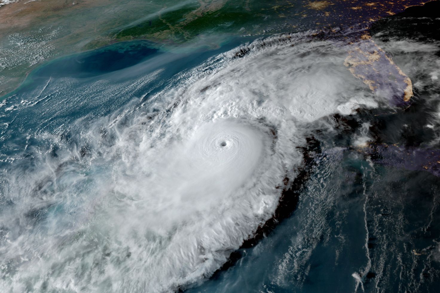
Additionally a 20-mile wide eye formed this morning.
As it stands, storm surges and high surf are the most critical expected local impacts, with 3-5 feet of peak surge in coastal Sarasota County, 4-7 feet in Manatee County and Tampa Bay, and perhaps 10-15 feet in the Big Bend area, where Idalia is forecast to come ashore Wednesday morning.
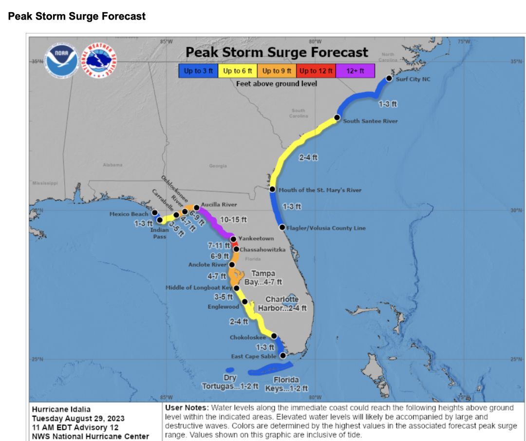
Idalia's peak storm surge forecast.
Image: NOAA
If you live on a barrier island, leave. If you are in an evacuation zone that has been told to evacuate, leave. Your escape routes may flood long before the storm hits peak.
Tonight and tomorrow morning will be rough along the shore. High tide tomorrow in Sarasota will be around noon, and onshore gale-force winds will likely blow water onto the shore.
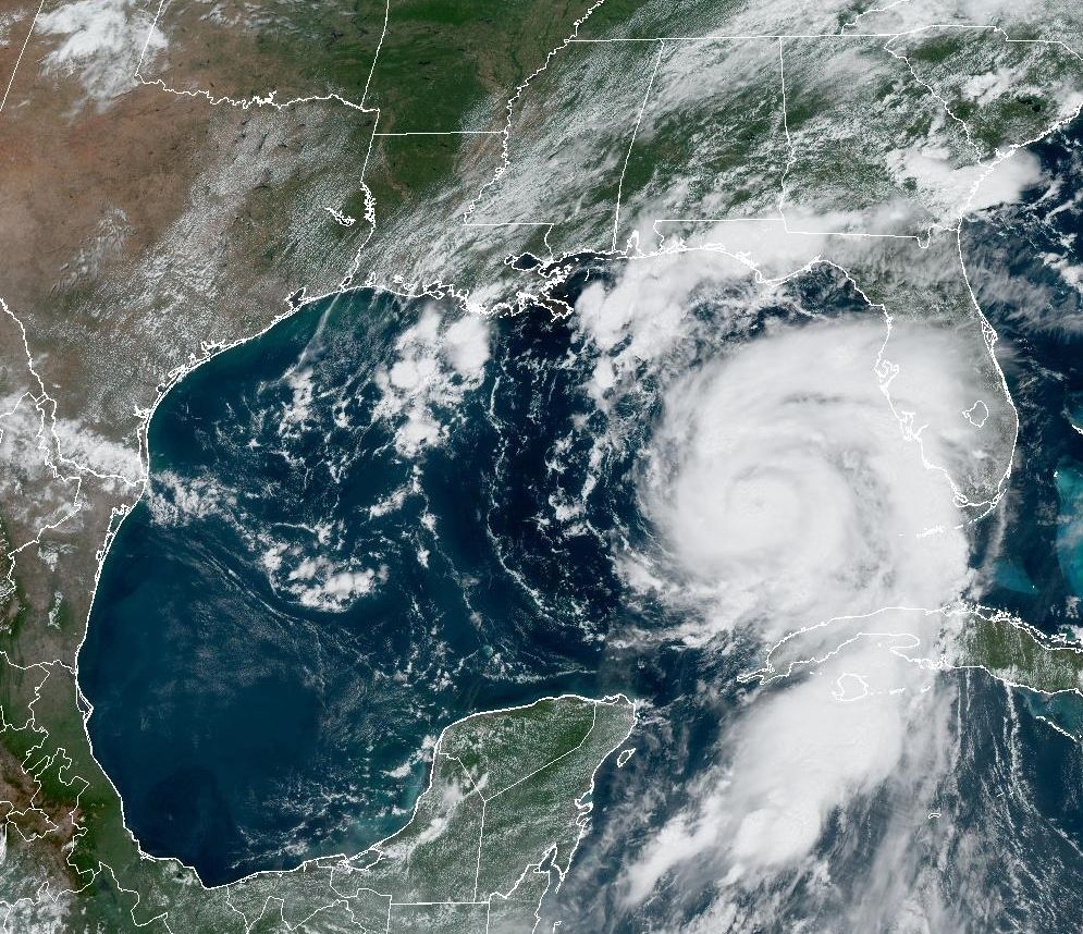
Idalia's path forecast is shown below, with appropriate warnings. Remember: the eye can be anywhere within the cone. Impacts can and will be well outside the cone.
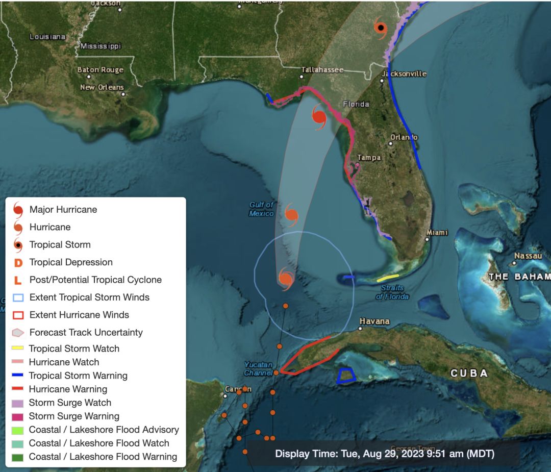
Idalia's projected path as of August 29, 2023.
Image: Courtesy Photo
Heavy rains from 2 inches to 6 inches are expected, with heavier amounts further north. Street flooding is likely.
Winds in the Sarasota metro area will gust from 50 mph at Sarasota Bradenton International Airport to 60-plus mph on Longboat Key and hurricane force in northern Manatee County. Gale-force winds should develop by late afternoon and continue thought the night and into Wednesday morning.
The winds around a hurricane blow counterclockwise, meaning the storm surges will be worst after the center of the storm moves north of your location. That means as the winds shift onshore and blow at gale-force or higher, water will surge onto the coastlines. A Category 2 or Category 3 storm today will have much higher surges and tides because sea level is 9 inches higher than it was in 1950. That is a lot!
Also increasing the tides is Wednesday's full supermoon. This is an important factor that will increase the impacts of the high tides—in addition to those 9 inches of sea level rise and record warm sea surface temperatures.
Make intelligent, science-based decisions. Protect your property but be sure to protect yourself!
Bob Bunting is a scientist, entrepreneur and educator and the CEO of the nation’s first Climate Adaptation Center (CAC), headquartered in Sarasota. The Climate Adaptation Center is an expert resource to inform government, academe and the private sector so they can create the necessary adaptation strategies and actions to protect the Florida way of life and foster the climate economy as well as larger global solutions evolve to solve the climate problem. For more information, visit theclimateadaptationcenter.org.