What Does El Niño Mean for Sarasota?
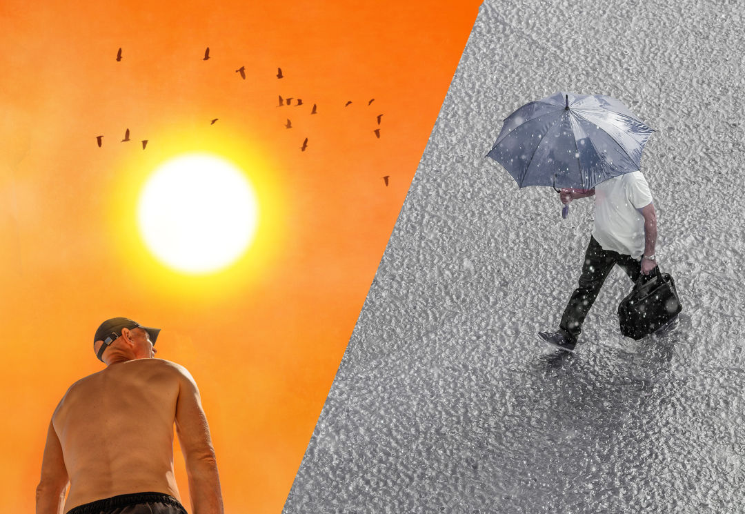
During an El Niño cycle, some areas of the country will experience drier weather, while others can expect to be drenched.
For such unassuming names, the weather patterns called El Niño and La Niña can have grave consequences for the world’s climate.
If you didn’t already know, we just left a La Niña cycle that began in September of 2020, and we're now projected to enter a five-year El Niño period. This week, the World Meteorological Organization (WMO) warned that this El Niño cycle will “push global temperatures into uncharted territory.” It is almost certain that the next five years will be the hottest in recorded history, pushing the global average temperature past the dreaded 1.5-degree Celsius mark.
But El Niño won’t affect all areas of the planet the same way. The whole world will not uniformly experience the same heat and weather. Some areas will experience drier weather, while others can expect to be drenched.
So what will El Niño do to Sarasota? And what is El Niño, anyway?
Typically, trade winds—the permanent, prevailing winds in the Earth's equatorial region—blow west along the equator in the Pacific Ocean. This moves warm water from South American to Asia. That warm water is replaced by cold water that rises from the bottom of the ocean. El Niño and La Niña are contrasting climate patterns that break these normal conditions.
During an El Niño pattern, trade winds weaken, and warm water is pushed back east. That causes the Pacific jet stream to head south, which creates dryer and warmer weather in the northern U.S. and Canada. But here on the Gulf Coast, we experience much wetter weather. La Niña does the opposite. That's why Florida has been experiencing extreme drought conditions, but also pleasantly cool nights because it’s not so humid.
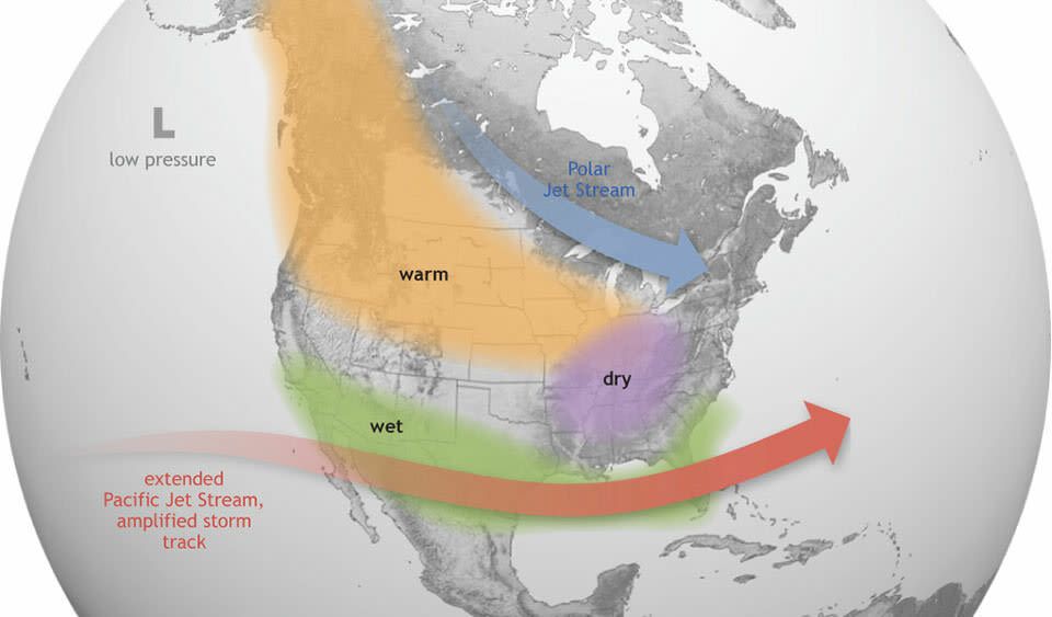
El Niño
Image: NOAA
Bob Bunting, a climate scientist and CEO of the Climate Adaptation Center, warns that El Niño will put an end to those nice cool nights we’ve had for the last three years.
“We had a really warm winter that was five degrees warmer, on average, than in the 1980s and '90s," Bunting says. "The weather was pleasant because there was little humidity."
The next five years won’t be like that. Bunting says that for each degree centigrade the atmosphere is warmed, seven percent more water is retained. When there is more moisture in the air, it makes things hotter.
“At night, we will get a greenhouse effect from all the water vapor in the atmosphere,” he says. “That vapor keeps the solar radiation that heats the earth in the lower atmosphere from escaping back into space at night.”
Bunting says we can expect to see muggy nights in the low 80s throughout the summer. “We are going to see more and more of this heat expression in our daily lives in Sarasota,” he says.
We can also expect more extreme weather because of the compounding effects of El Niño and climate change. “All these storms loaded with water vapor will bring more rain and stronger storms,” Bunting explains. “And the storms move slower than they used to because the jet streams are weaker, so they cause more damage at every location that they pass over.”
While we can expect noticeably hotter weather, Bunting says he doesn’t expect to see sea level change within the next five years. While warmer weather does makes the oceans expand, we likely won’t see significant sea level rise until the 2030s. However, all that rain does threaten to overwhelm our already already-stressed wastewater systems.
“Sarasota is at a critical point in its development,” Bunting says. “In the next five years, we are going to decide whether we can keep Sarasota this special place, or whether we are going to make it a heat island that’s going to fry everyone.”
Our future depends on the way we continue to develop. It’s no secret that Sarasota is developing at a breakneck pace, so if we are going to continue to build, we have to do so in a way that adapts to our changing climate.
“If we keep building the way that we are, where every building becomes an 18-story concrete super-edifice that does not absorb heat and instead radiates it all throughout the night, we are going to be in trouble,” Bunting warns.
I often wonder how the 700,000 people who moved to Florida since 2020 will fare in the predicted heat. How will all those northerners and midwesterners who have experienced relatively tepid summers (barring Hurricane Ian, of course) handle a much wetter, muggier and hotter summer? Will they hightail back north when they get a load of their electric bills? Which, by the way, are set to increase up to 20 percent per month after Florida’s three major power companies, Florida Power & Light, Duke Energy Company Tampa Electric Company went before the Florida Public Service Commission (PSC)—the agency that regulates utilities—to ask to increase the cost of electricity to make up for last year’s costs associated with volatile fuel prices and damaging hurricanes like Ian.
Perhaps there is a silver lining here somewhere. These conditions are not terminal. El Niño will end and extreme weather events could subside. And we can choose to see the intensity of these next five years as a final warning shot from the earth.
“We have to remain optimistic,” says Bunting. "No big problem has been solved from pessimism.”