Tropical Storm Nicole: Warnings and Storm Surge Impacts for Tonight and Thursday
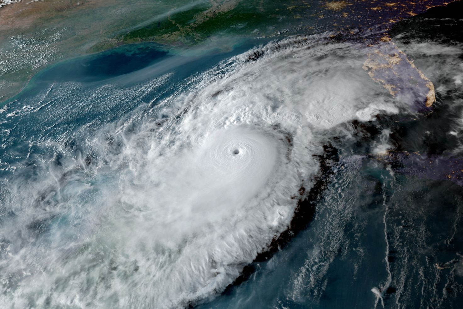
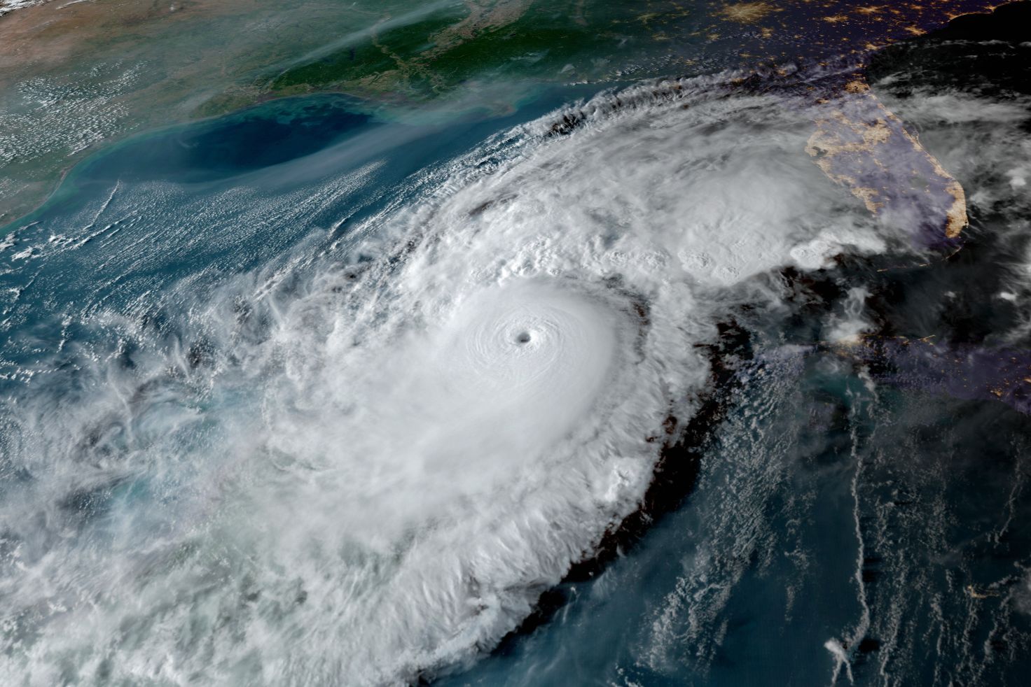
Tropical Storm Nicole is forecast to become a hurricane before making landfall tonight.
Image: NOAA
A tropical storm warning is in effect for the Suncoast tonight and tomorrow. That means we can expect:
- Gale force winds gusting from 50-55 miles per hour on the mainland and 55-65 miles per hour on the barrier islands late tonight and tomorrow morning, regardless of the path of the storm.
- Storm surge of one to three feet along the beaches and bayfronts at high tide tonight and tomorrow.
- Heavy rain at times, with two to four inches, is possible.
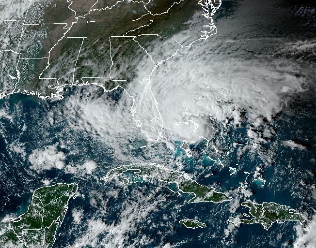
A look at Tropical Storm Nicole's predicted path
Nicole is near hurricane force, with 70 mile-per-hour sustained winds, and is forecast to strike as a Category 1 hurricane this evening just north of Miami. Hurricane warnings are flying on much of Florida's east coast.
Storm surges are expected over much of the east coast of Florida, extending north through Georgia, and from Englewood to Indian Pass on the west coast of the state.
Nicole is very large. The wind field guarantees impacts for much of Florida, regardless of where the center of the storm is located. It will move at an increasing forward speed across the state once landfall occurs.
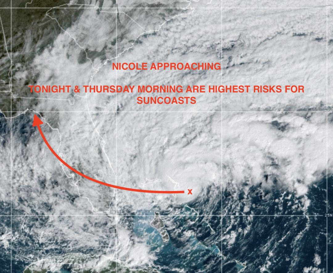
The peak surge map, below, emphasizes the areas where storm surge will create flooding issues. Significant segments of Florida's coastline will have high water issues.
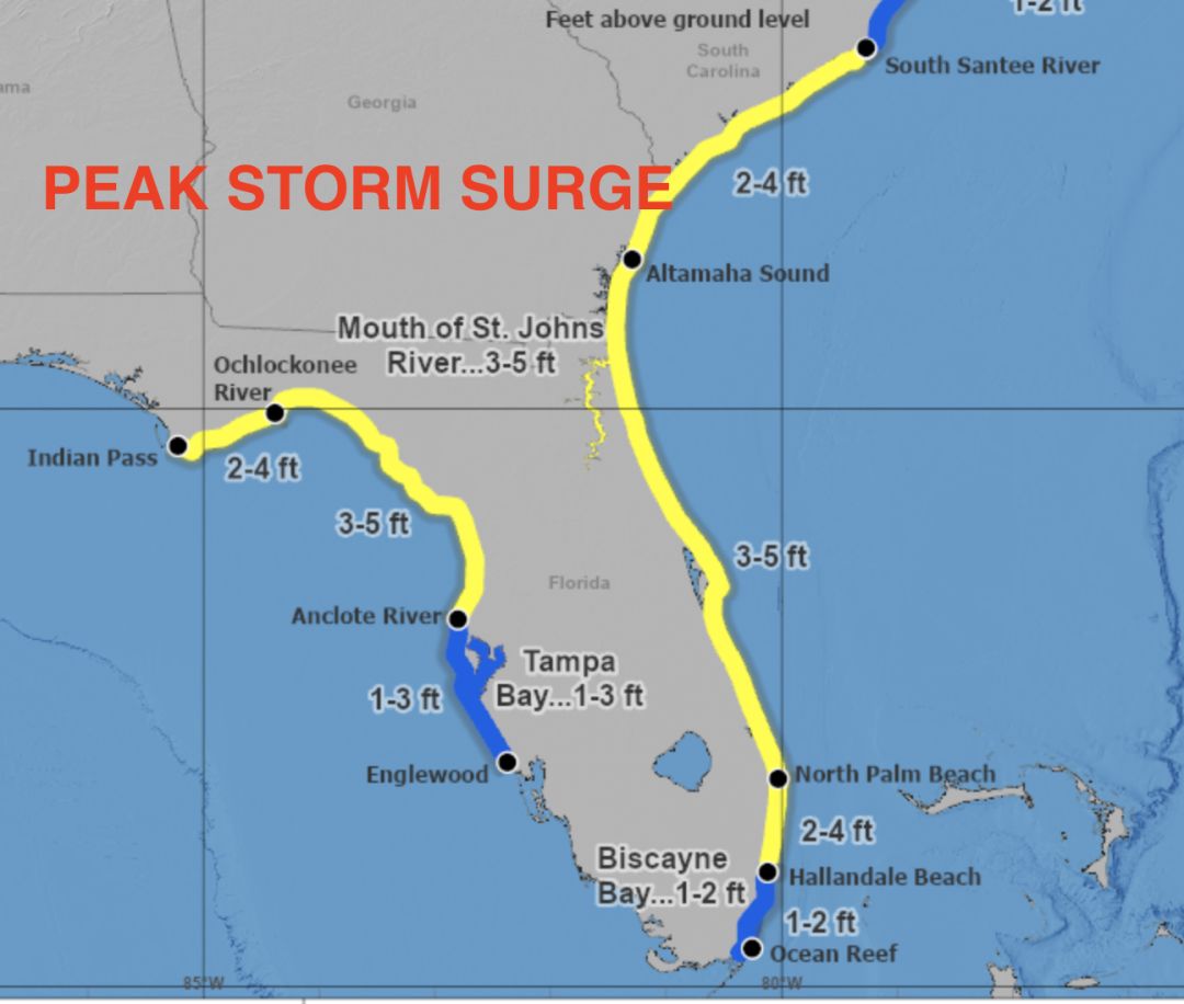
A look at peak storm surge for Tropical Storm Nicole
Image: Climate Adaptation Center
From Englewood north though the Gulf Coast and Tampa Bay, expect storm surges tonight and tomorrow from one to three feet. That's enough to flood low-lying areas, including roadways and neighborhoods that are already prone to flooding due to sea level rise. All of our barrier islands and the bayfront could have flooding issues, especially around the high tides tonight around midnight and tomorrow in the early afternoon.
A near full moon means higher tides even without a storm and as such, Nicole's gale force winds will drive water onto the beaches and bay fronts. This time of year, high tides are at their highest.
Bob Bunting is a scientist, entrepreneur and educator and the CEO of the nation’s first Climate Adaptation Center (CAC), headquartered in Sarasota. The Climate Adaptation Center is an expert resource to inform government, academe and the private sector so they can create the necessary adaptation strategies and actions to protect the Florida way of life and foster the climate economy as well as larger global solutions evolve to solve the climate problem. For more information, visit theclimateadaptationcenter.org.