Tropical Storm Nicole Is Slowly Moving Toward the Bahamas, Southeast Florida Coast
Tropical Storm Nicole is becoming better organized.
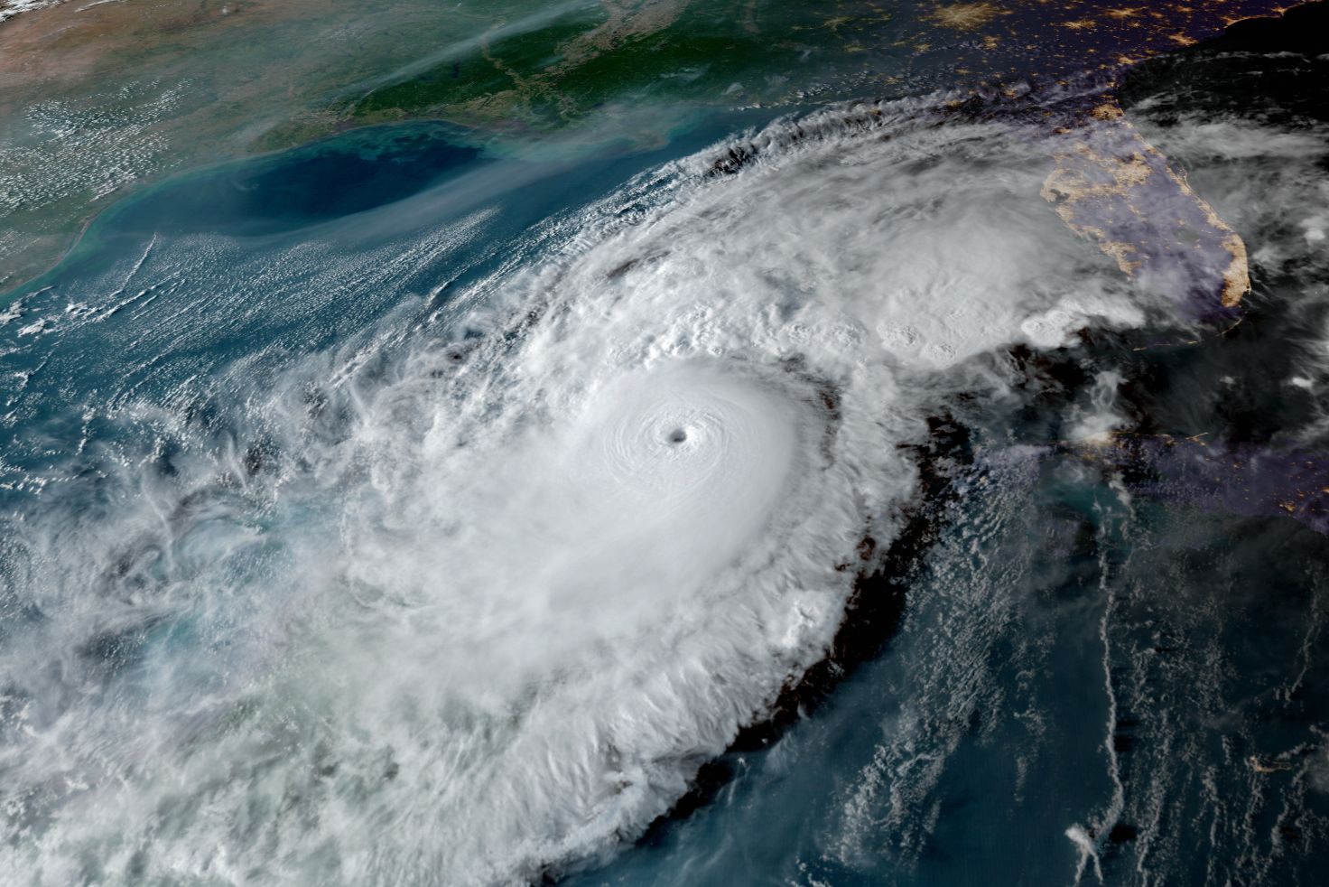
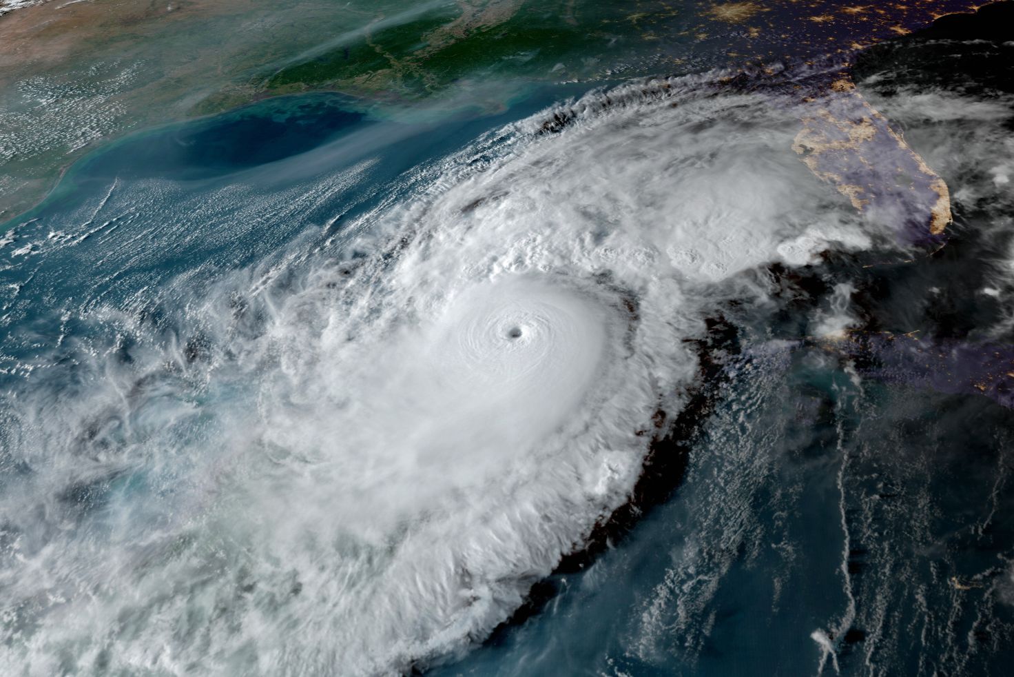
Image: NOAA
Tropical Storm Nicole is strengthening and getting well-organized as it moves slowly west-southwest toward the southeast Florida coast and the northwest Bahamas, as indicated in last night's update.
Hurricane warnings are flying along a large portion of the coast, with Nicole expected to make landfall as a Category 1 hurricane close to North Palm Beach late tomorrow afternoon or early evening. Storm surges are expected over much of the east coast of Florida and extending north though Georgia.
Nicole is very large, with sustained winds now at 60 miles per hour. Because of that, its wind field guarantees impacts for much of Florida, regardless of where the center of the storm is located.
The storm will move at an increasing forward speed across the state once landfall occurs. A tropical storm watch is in effect for the west coast of Florida from just north of Bonita Beach to the Ochlockonee River. Storm surge of one to three feet is expected from Longboat Key to Tampa Bay, and two to four feet to the north of Tampa Bay.
The Suncoast will face tropical storm conditions beginning Wednesday night and continuing though a good portion of Thursday. Because of Nicole's size, gale force winds are expected regardless of its exact path. Heavy rains of 2 inches to 4 inches should occur. Personally, I am worried most about the possibility of coastal flooding along the barrier islands and bayfronts from Venice to Tampa Bay and northward.
From September 2 though today, eight storms have formed. Should Nicole become a hurricane, as I expect, all eight will have been hurricanes. As I said last night, such is life in a climate-warmed world!
The NOAA satellite image at top shows dramatic improvement in the organization of Nicole as it nears hurricane status. Note how the center looks typical of a hurricane and the spiral bands forming around the center like a pinwheel.
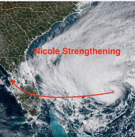
The path shown is a general vector of expected movement but therein lies the threat for the Suncoast. Please be aware that the location of severe weather around the center will evolve and change as the system continues to evolve. That is why I want you to focus on the impacts rather than the exact path.
There has been a slight northward shift in the storm's path since last night. If that trend continues, the onshore winds in the Sarasota-Bradenton metro area will be brisk, but not much above 40 mph. Still, we have issues with water because:
- Winds will therefore be onshore, the opposite of what occurred with Hurricane Ian;
- A near full moon means higher tides even without storms; and
- High tides this time of year are the highest of the year.
We need to be prepared for very high tides, some storm surge with onshore winds if the center does pass just north of Sarasota, and enhanced flooding due to the storm passing close to the time of high tide and a near-full moon.
Bob Bunting is a scientist, entrepreneur and educator and the CEO of the nation’s first Climate Adaptation Center (CAC), headquartered in Sarasota. The Climate Adaptation Center is an expert resource to inform government, academe and the private sector so they can create the necessary adaptation strategies and actions to protect the Florida way of life and foster the climate economy as well as larger global solutions evolve to solve the climate problem. For more information, visit theclimateadaptationcenter.org.