High Sea Surface Temperatures, Dissipating Saharan Dust and More: Conditions For Hurricane Formation Are Becoming Ideal
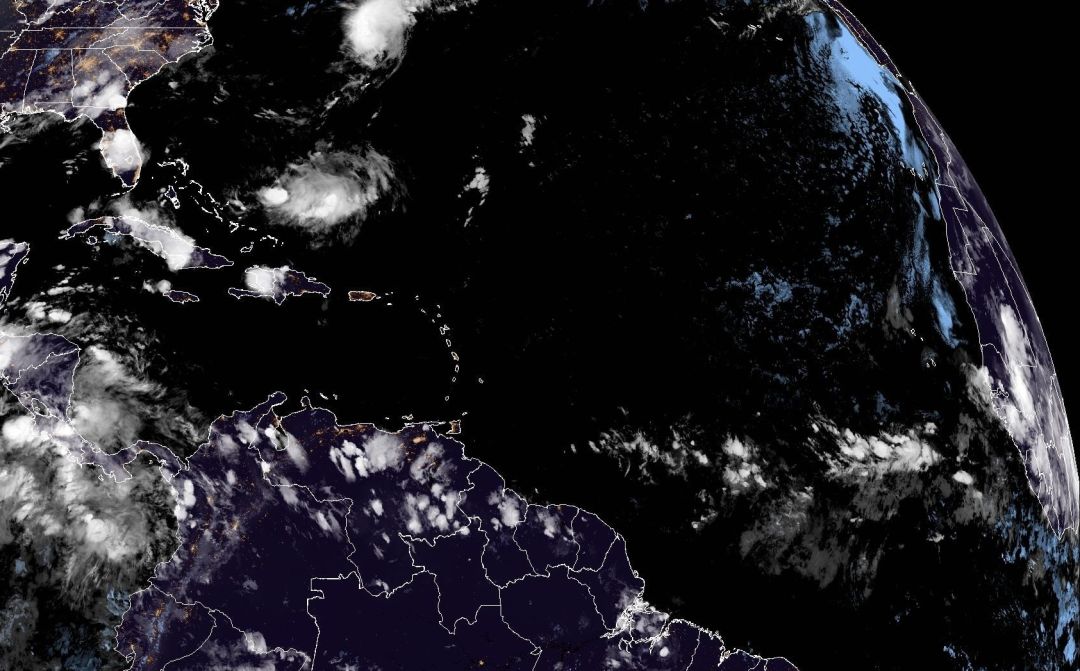
Image: NOAA
No one is looking forward to the peak of hurricane season after last year's trifecta of storms—but we have to deal with it in the best way possible, so that is what we will do.
Some may think we have had a quiet season so far, but today Tropical Storm Dexter, the fourth named storm of this young season, formed in the Atlantic. (Remember, hurricane season runs through Nov. 30.) It will not be a threat to the United States.
The early hurricane season tends to have tropical storms and not hurricanes, but conditions are ripening for the start of the "true" season, which extends from about now through the first part of November.
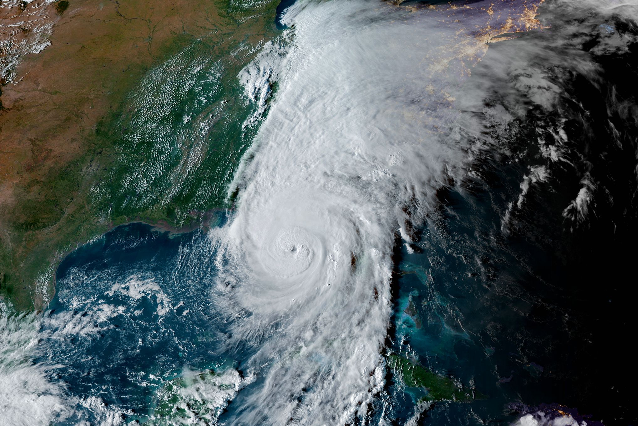
This year, sea surface temperatures are very warm—especially in the Gulf and Caribbean—which means any storm that takes shape there could intensify rapidly. Rapid intensification is a new reality and a very dangerous one. Storms forming near land can build from tropical storms to Category 5 hurricanes in a day or so. Just look at Hurricanes Helene and Milton last year, Hurricane Ian in 2022, and Hurricane Michael in 2018. In these types of cases, warnings won't allow much time to prepare.
Specifically, Gulf sea surface temperatures are near 90°F right now, and these super warm waters are holding massive heat content that hurricanes love.
Plus, the heavy dust that swept into the Atlantic from the Sahara Desert, so common in the early season, is now showing signs of dissipating. Dust holds down hurricane development. Once it clears, watch out.

Here, a timely image from our GOES-R Satellite shows both clouds and dust. The heavy dust is shown in the color magenta. I've circled an area of very heavy dust so you can get the hang of seeing the variations across the tropical Atlantic.
The red areas are heavy clouds. Notice that Tropical Storm Dexter is located well off the mid-Atlantic coast. Now look at the area west of Africa, where there's a good chance another named storm will form. If it does, it will be late this week and will be named Erin, as I have indicated on the image.
Two cloud systems on either side of the white star may also join forces late this week and provide a third potential for storm formation. Finally, the central part of Africa, to the east of the white line where it says, "Big Wave," is a large system that will move into the tropical Atlantic in the days ahead. I'm watching this one!
The conditions the CAC has been forecasting for another active hurricane season are coming together.
Below is the National Hurricane Center graphic description of what I just described, without comment on the wave over central Africa. Orange areas in the above image indicate a good chance for future development, while yellow areas have some chance of development (but only about 20 percent). Red is reserved for named systems of nearly certain near-term development.
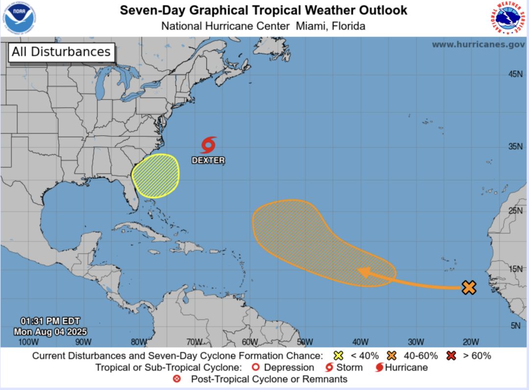
Image: NOAA
Below is the NHC forecast movement and intensity forecast for Tropical Storm Dexter as it moves away from the U.S.

Be Prepared
Hurricane season runs through Nov. 30, 2025, and it's important to be prepared. Here's what to know ahead of a storm.
- Get an emergency supply kit ready
- Know your evacuation levels
- Know your flood zone
- Create an evacuation plan
- Understand your home's construction and wind tolerance
- Understand storm related terminology
- Stay informed
For more ways to prepare, click here.
Bob Bunting is a scientist, entrepreneur and educator and the CEO of the nation’s first Climate Adaptation Center (CAC), headquartered in Sarasota. The Climate Adaptation Center is an expert resource to inform government, academe, the private sector and philanthropy so they can create the necessary adaptation strategies and actions to protect the Florida way of life and foster the climate economy while larger global solutions evolve to solve the climate problem. The 2025 CAC Florida Climate Conference will take place on Thursday, Nov. 13, 2025, at the University of South Florida Sarasota-Manatee.