In Worst-Case Scenario, Sarasota Is Ground-Zero for Hurricane Milton

Image: NOAA
The Climate Adaptation Center—which will hold its fourth annual Florida Climate Conference on Nov. 14-15—has been issuing updates as we learn more about Hurricane Milton. Here’s the latest from meteorologist and CAC founder and CEO Bob Bunting.
Winds at the Sarasota Bradenton International Airport have already reached 50 miles per hour as Milton sets its sight on Sarasota and the Suncoast.
In our Friday update, we put the Suncoast on notice that Milton would form, become a major hurricane (category 3 or higher) and possibly hit the Suncoast—and—Sarasota today.
My worst fears are now being realized as Milton closes in as a Category 3 storm. It will cross the coastline very close to Sarasota tonight between 10 p.m. and 2 a.m.
Timelapse flying by Hurricane Milton about 2 hours ago.
— Matthew Dominick (@dominickmatthew) October 8, 2024
1/6400 sec exposure, 14mm, ISO 500, 0.5 sec interval, 30fps pic.twitter.com/p5wBlC95mx
High tide in Sarasota is at 4:32 a.m. on Thursday morning, and Milton's eye will pass within a few hours of that time according to the latest projections. Strong to historic storm surge is expected near and south of the eye.
Errors of about 20 miles one way or another are normal at this point, so stay focused at Milton approaches. Many storms have wobbled as they approach the coast, so this one may do it, too.
Remember, Milton's impacts will be severe throughout the Sarasota-Bradenton metro area even if the eye shifts a bit one way or the other before landfall.
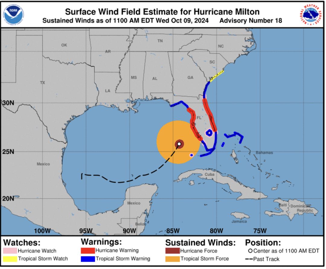
Image: Courtesy Photo

Image: Courtesy Photo
Track
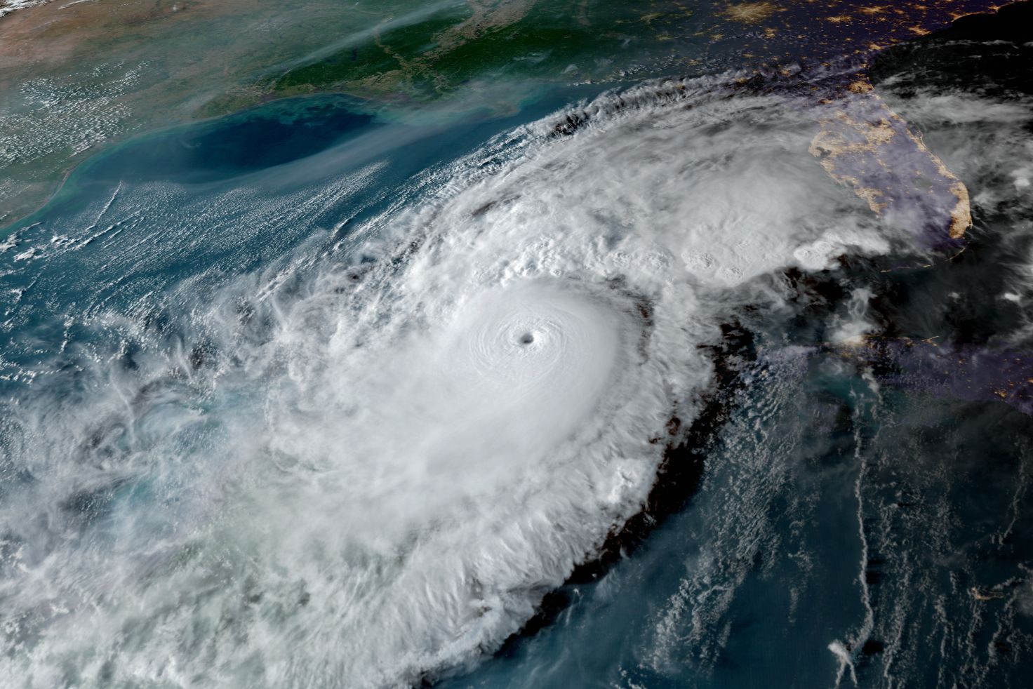
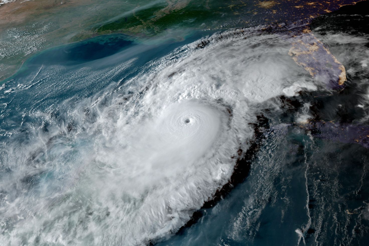
Milton's approach is best shown by the two images above. The first shows the warning areas, previous track, and the present reach of both hurricane-force and tropical storm-force winds.
The second image shows the current path projection with Milton coming into Sarasota. This track can still change by about 20 miles one way or another. While the impacts will largely be unchanged in general, big changes in impacts in places close to the eye crossing the coastline will occur.

Image: Courtesy Photo
Storm Surge
The Suncoast will experience 10-feet-high to 15-feet-high maximum storm surge should Milton pass close to high tide. Wave action, driven by hurricane-force winds, will occur on top of that.
A recent satellite image shows how Milton is growing in size—a trend that should continue as the storm approaches.

Image: Courtesy Photo
Winds and Wind Gusts
Winds are already at gale force and expected to increase along the Suncoast tonight. Many areas will see winds peak at or above 100 miles per hour tonight and Thursday morning.
Significant wind damage from the winds, especially close to the eye, and from spin-up tornadoes is expected.
This recent radar image shows the spiral band moving onto the coastline; there are already seven tornado warnings in progress south of the Suncoast.
Milton's eye is located in the bottom left of the image.
Be safe when warnings are issued in your area. Go into an interior bathroom and get into your tub with blankets and pillows covering you. This is your safest location unless you can be in a basement, which is rare in our area.
The storm will traverse the entire state from west to east as a hurricane. This means damage will be widespread even inland.
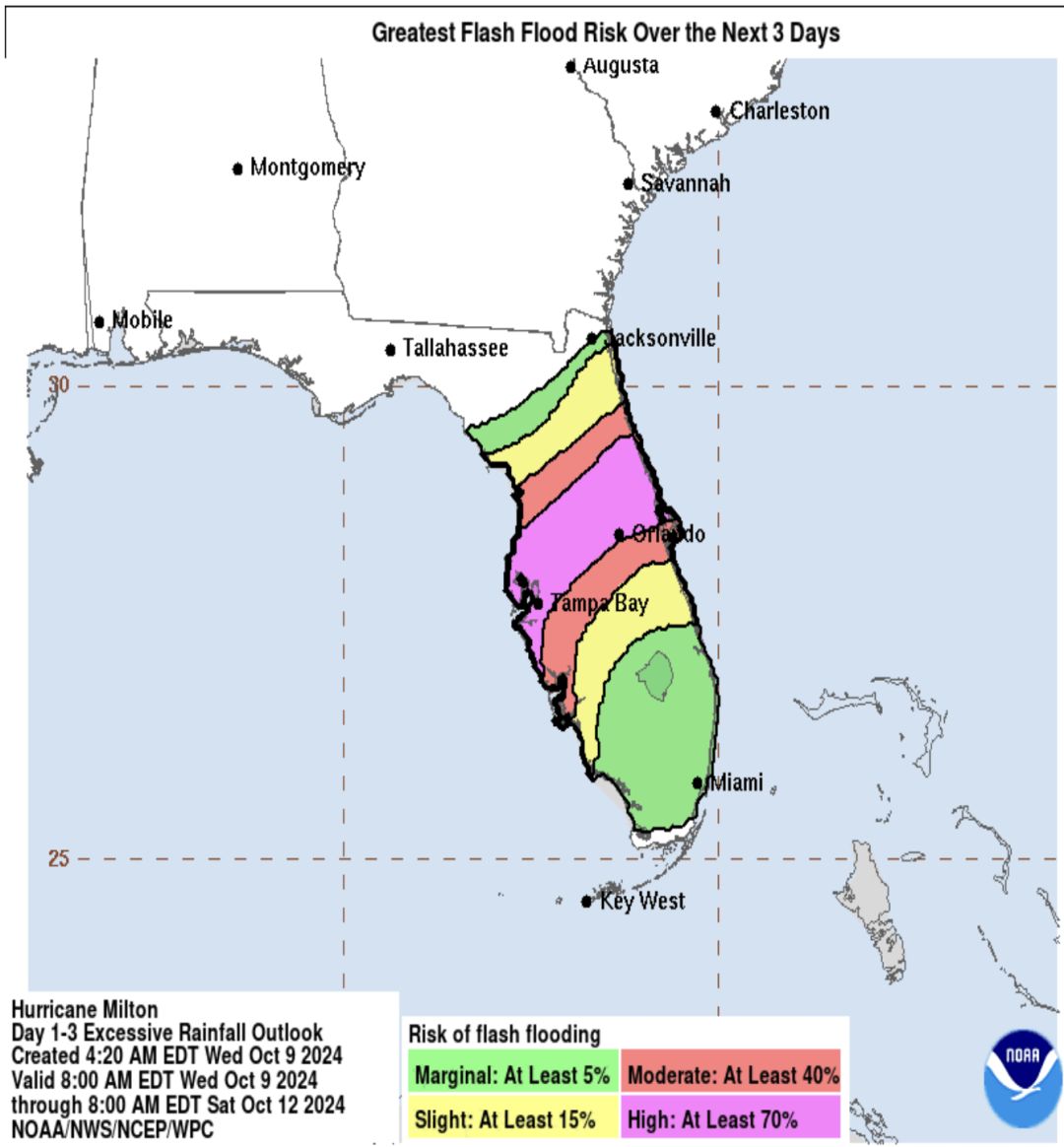
Image: Courtesy Photo
Heavy Rains and Flooding
Six to 12 inches of rain will also be falling on very saturated grounds because of the more than 50 inches of rain that fell in our region summer. Flash flood potential and flood potential are risks starting right now.
As this historic event unfolds in our backyard, please use your head and stay put. Don't venture out tonight at all—especially if the eye passes over you. The winds will die off temporarily once the eye wall passes, but there won't be much time until ferocious winds begin again and strike from the opposite direction.
Please stay put and stay safe. The Climate Adaptation Center's background in climate-induced events is more than 100 years deep. Our community has been warned on every detail. Now it is up to you.
We wish you well and hope you and your loved ones safely come safely this historic event.
Bob Bunting is a scientist, entrepreneur and educator, and the CEO of the nation’s first Climate Adaptation Center (CAC), headquartered in Sarasota. The Climate Adaptation Center is an expert resource to inform government, academe, the private sector and philanthropy so they can create the necessary adaptation strategies and actions to protect the Florida way of life and foster the climate economy while larger global solutions evolve to solve the climate problem. Its fourth annual Climate Conference takes place Nov. 14-15. Contact Bob at [email protected] for more information.