Hurricane Milton Expected to Bring Catastrophic Impacts to the West Coast of Florida
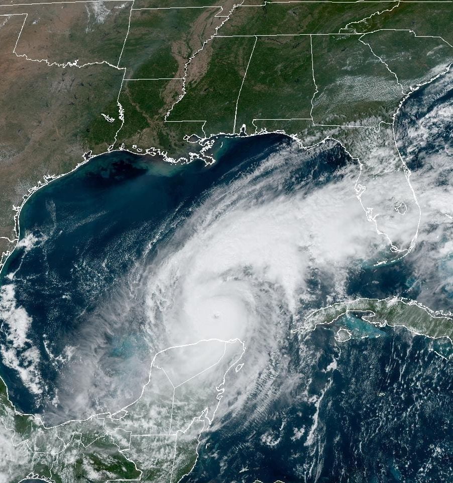
Image: NOAA
The Climate Adaptation Center—which will hold its fourth annual Florida Climate Conference on Nov. 14-15—has been issuing updates as we learn more about Hurricane Milton. Here’s the latest from meteorologist and CAC founder and CEO Bob Bunting,
Major to catastrophic impacts from Hurricane Milton's hurricane-force winds, storm surge and excessive rain are all but certain Wednesday and Thursday all along the west coast of Florida north to the Big Bend area.
Timelapse flying by Hurricane Milton about 2 hours ago.
— Matthew Dominick (@dominickmatthew) October 8, 2024
1/6400 sec exposure, 14mm, ISO 500, 0.5 sec interval, 30fps pic.twitter.com/p5wBlC95mx
Specifically for the Sarasota-Manatee metro area, the eye of Milton will likely pass over or close to our area late Wednesday night and Thursday early morning.
High tide in Sarasota is at 4:32 a.m., the eye will pass within a few hours of that time, according to the latest projections. The Sarasota-Manatee/Tampa Bay area will experience the worst of the storm because Milton's eye will be passing over us during that stretch of time.
Errors in path of about 60 miles one way or another are normal at this point, so stay focused as Milton approaches. Many storms have wobbled as they approach the coast. This one may do it too.
But remember, the impacts will be severe throughout our metro area even if the eye shifts a bit one way or the other before Milton makes landfall.
Do not focus on the point where the eye crosses the coast.
Preparations should be completed by today. Do not second guess the experts or our community leaders. Given the risk, they will let you know about evacuations, shelters etc. Please do what they say. It could save your life!
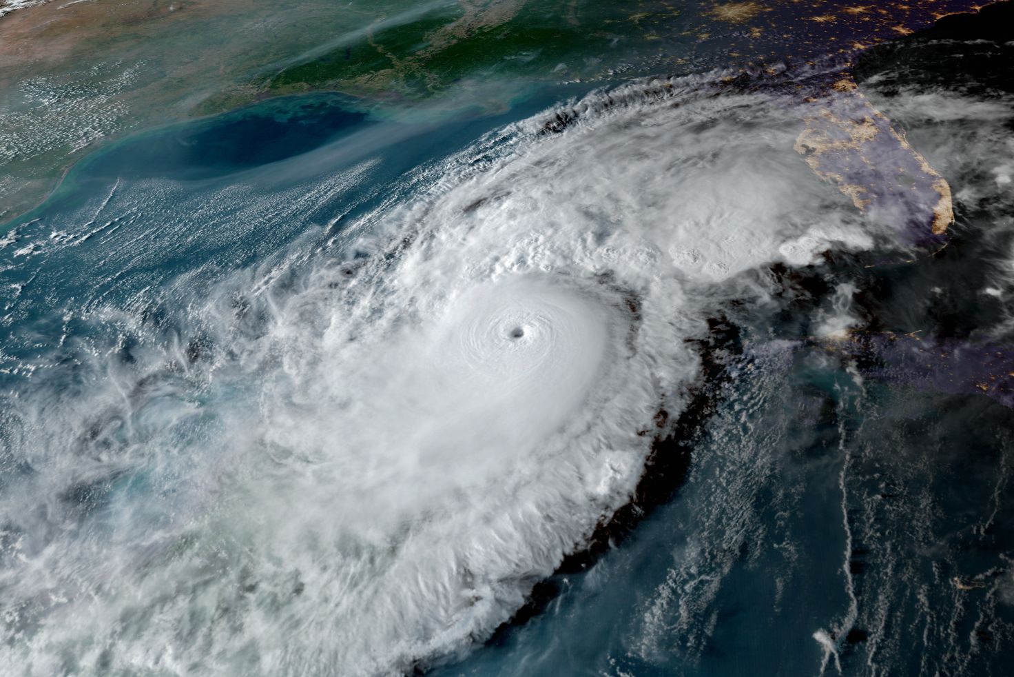
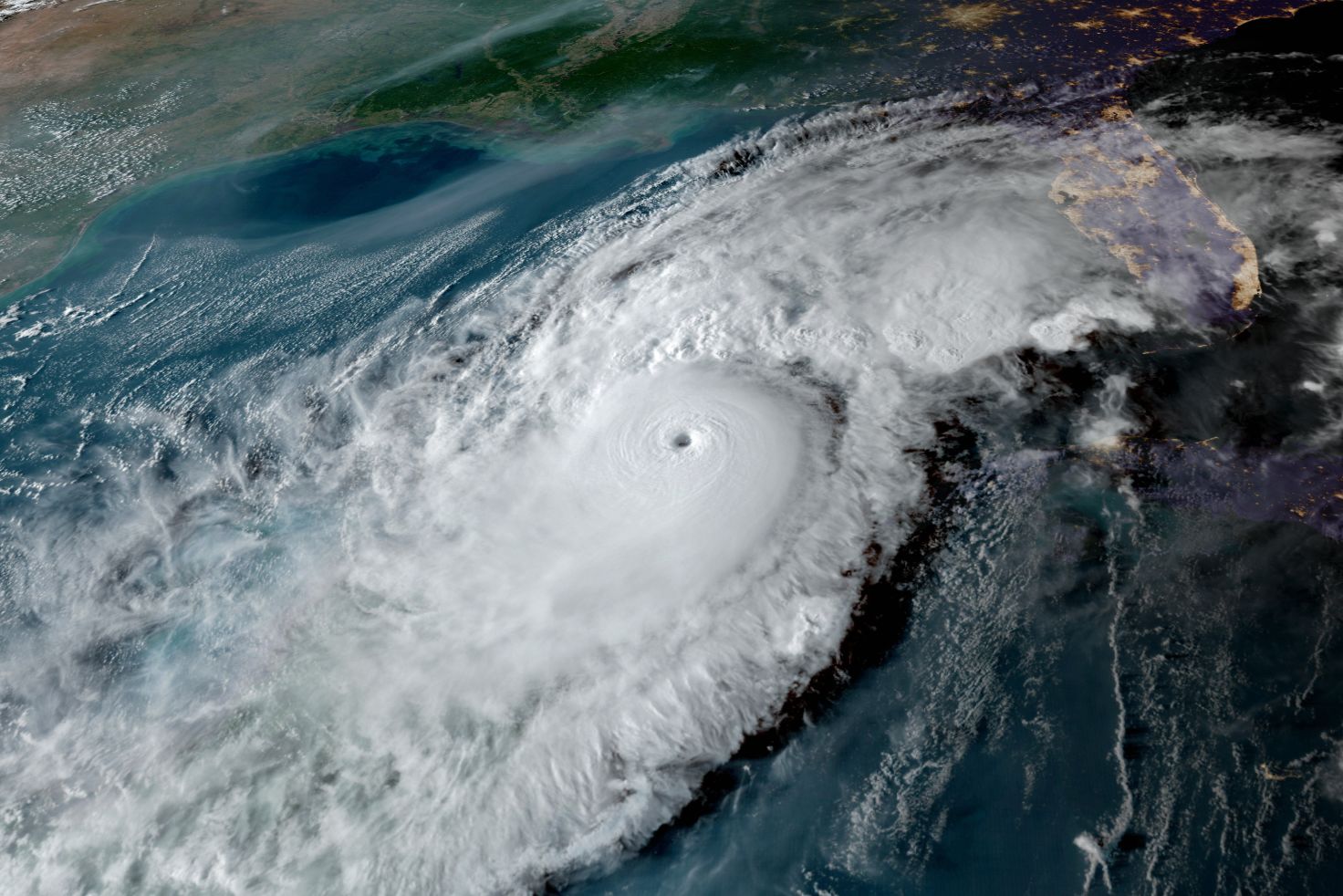
Milton is growing in size today after a historic rapid intensification cycle in which the storm intensified from a tropical storm to a Category 5 hurricane in just one day. It also intensified from a Category 3 hurricane to a Category 5 hurricane in just 5 hours. The lowest pressure it reached yesterday was 897 millibars—making it one of the five most intense storms in history.
Yesterday, I mentioned an Eye Replacement Cycle (ERP) could happen today—it has already completed, with a minor lessening of the peak winds from 180 mph to 155 miles per hour. It also triggered an expansion in the size of Milton's hurricane-force winds, which I am certain will continue to expand.
Storm surge is going to be about as bad as it can get for us.
A large portion of the middle swath of the west Florida coast will see 10-feet-high to 15 feet-high maximum storm surges. Wave action, driven by hurricane force winds, will happen on top of that.
Do the math. If you live at 8 feet above sea level and a storm surge of 15 feet strikes you, you are not going to survive.
Evacuate as you have been told by local officials. Here's how to find your zone.
Know your elevation.
Escape routes will flood well before Milton makes landfall.
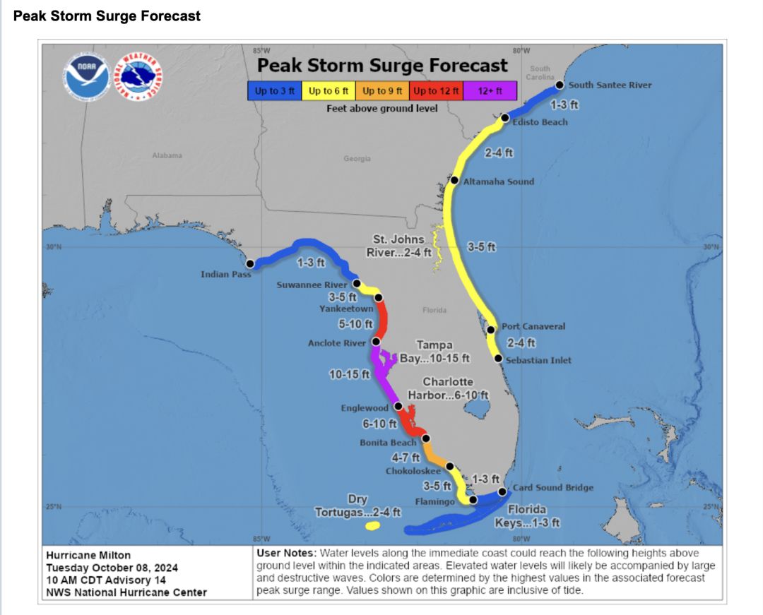
Image: NOAA

Image: Courtesy Photo
Above, a satellite image shows how Milton is growing in size—a trend that should continue as the storm approaches the west coast of Florida.
Milton's very unusual path is continuing across the Gulf of Mexico from west to east, over a very warm Gulf and a loop current within the Gulf.
Don't be surprised to see the storm strengthen more today as its circulation passes right over the loop current, which contains maximum heat content.
Winds and guests are expected to increase along the Suncoast, especially after sunrise on Wednesday. Many areas will see winds peak at or above 100 miles per hour on Wednesday night and Thursday morning.
Be sure you clean your patios, move autos to higher ground, secure any loose debris. You can help ensure your own safety and the safety of others.

Image: NOAA
Warnings and watches are in effect, as shown above.
The storm will traverse the entire state, from west to east, as a hurricane. This means damage will be widespread even inland.

Image: Courtesy Photo
Six to 12 inches of rain will also be falling on very saturated grounds from the more than 50 inches of rain that have already fallen this summer. Flash flood and flood potential are risk.
Time is getting short to prepare for this storm. Please heed the advice of officials.
Bob Bunting is a scientist, entrepreneur and educator, and the CEO of the nation’s first Climate Adaptation Center (CAC), headquartered in Sarasota. The Climate Adaptation Center is an expert resource to inform government, academe, the private sector and philanthropy so they can create the necessary adaptation strategies and actions to protect the Florida way of life and foster the climate economy while larger global solutions evolve to solve the climate problem. Its fourth annual Climate Conference takes place Nov. 14-15. Contact Bob at [email protected] for more information.