Hurricane Milton Is Now a Category 5 Storm. Here's What You Need to Know.

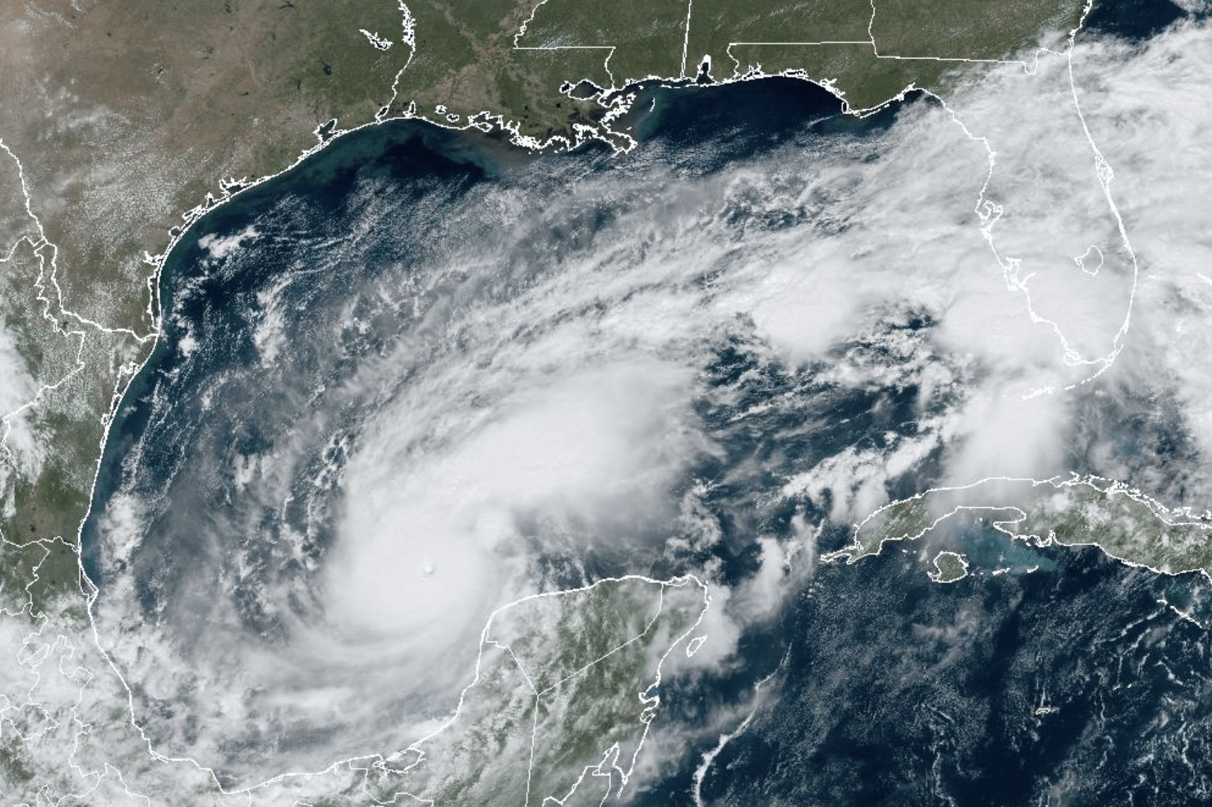
Image: NOAA
The Climate Adaptation Center—which will hold its fourth annual Florida Climate Conference on Nov. 14-15—has been issuing updates as we learn more about Hurricane Milton. Here’s the latest from meteorologist and CAC founder and CEO Bob Bunting,
Hurricane Milton, now a Category 5 hurricane with 175 mile per hour winds, has just gone through a mind-numbing rapid intensification that would have been nearly impossible 100 years ago. In fact, Milton has undergone one of the three fastest intensifications on record—and it's still getting stronger.
At 10:28 a.m. EDT October 7, the space station flew over Hurricane Milton and external cameras captured views of the category 5 storm, packing winds of 175 miles an hour, moving across the Gulf of Mexico toward the west coast of Florida. pic.twitter.com/MTtdUosiEc
— International Space Station (@Space_Station) October 7, 2024
Major to catastrophic impacts from major hurricane-force winds, storm surge and excessive rains are all but certain Wednesday along the Florida west coast up to the Big Bend area.
The Tampa Bay area, including Sarasota-Manatee, will experience the worst, with Milton's eye passing within that stretch. There are still more than 48 hours to go, so adjustments to the exact location of where Milton's eye will come ashore will continue. Those adjustments—which will be about 75 miles one way or another—are normal at this point, so stay focused as the storm approaches.
Milton is small compared to Debby and Helene, but it will grow in size over the next few days as it shifts into a northwest motion toward the mid-Florida west coast.
We already know the Suncoast will be in the hurricane zone and will have major impacts. All preparations should be completed by Tuesday. Do not second-guess the recommendations of experts or community leaders. Please do what they say. It could save your life!
With extreme hurricanes like Milton, there is usually an Eye Replacement Cycle (ERP), in which the storm's existing eye decays and a new one forms. Late Tuesday and Wednesday, we may see that ERP. During such cycle,s winds can diminish some but the storm grows in physical size. That's why I think Milton will be a large and powerful storm when it strikes, even if its maximum intensity is off from its peak.
Storm surge is going to be about as bad as it can get for our region.
A large portion of the mid west Florida coast will see 8-foot-high to 12-foot-high storm surge. Wave action driven by hurricane-force winds will happen on top of that. If you are on the barrier islands: get off. Make sure to know your elevation, as escape routes will flood well before Milton makes landfall.

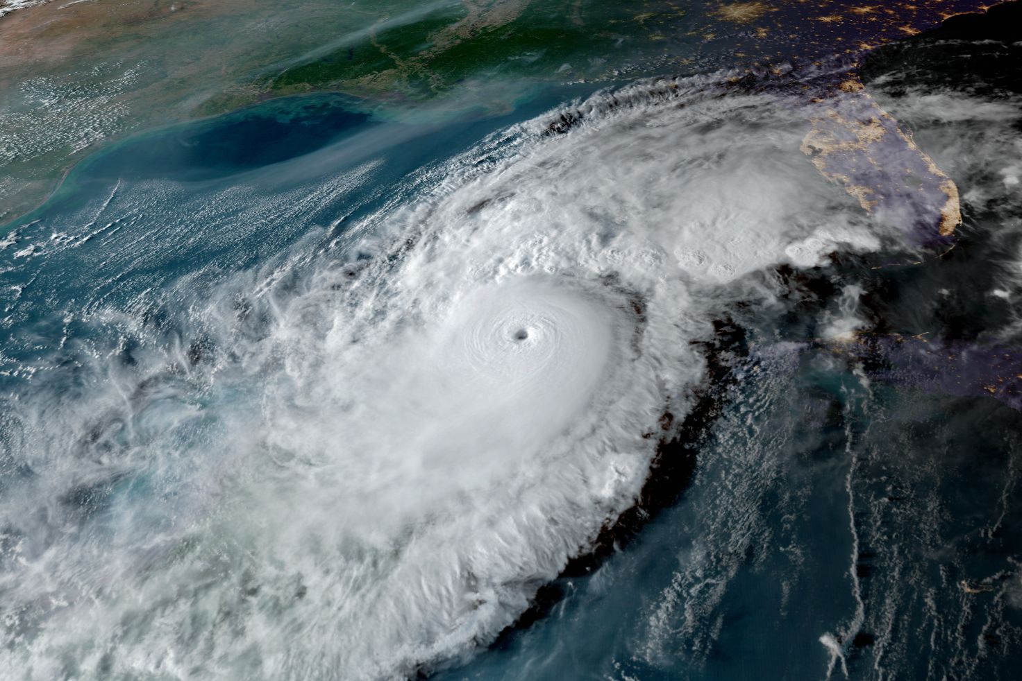
Image: Courtesy Photo
Very high winds and wind gusts are also expected along the Suncoast. Many areas will see winds at or above 100 miles per hour.
Six to 12 inches of rain will also fall on already-saturated grounds due to the more than 50 inches of rain that fell in our region this summer. Flash floods and other flooding are also risks.
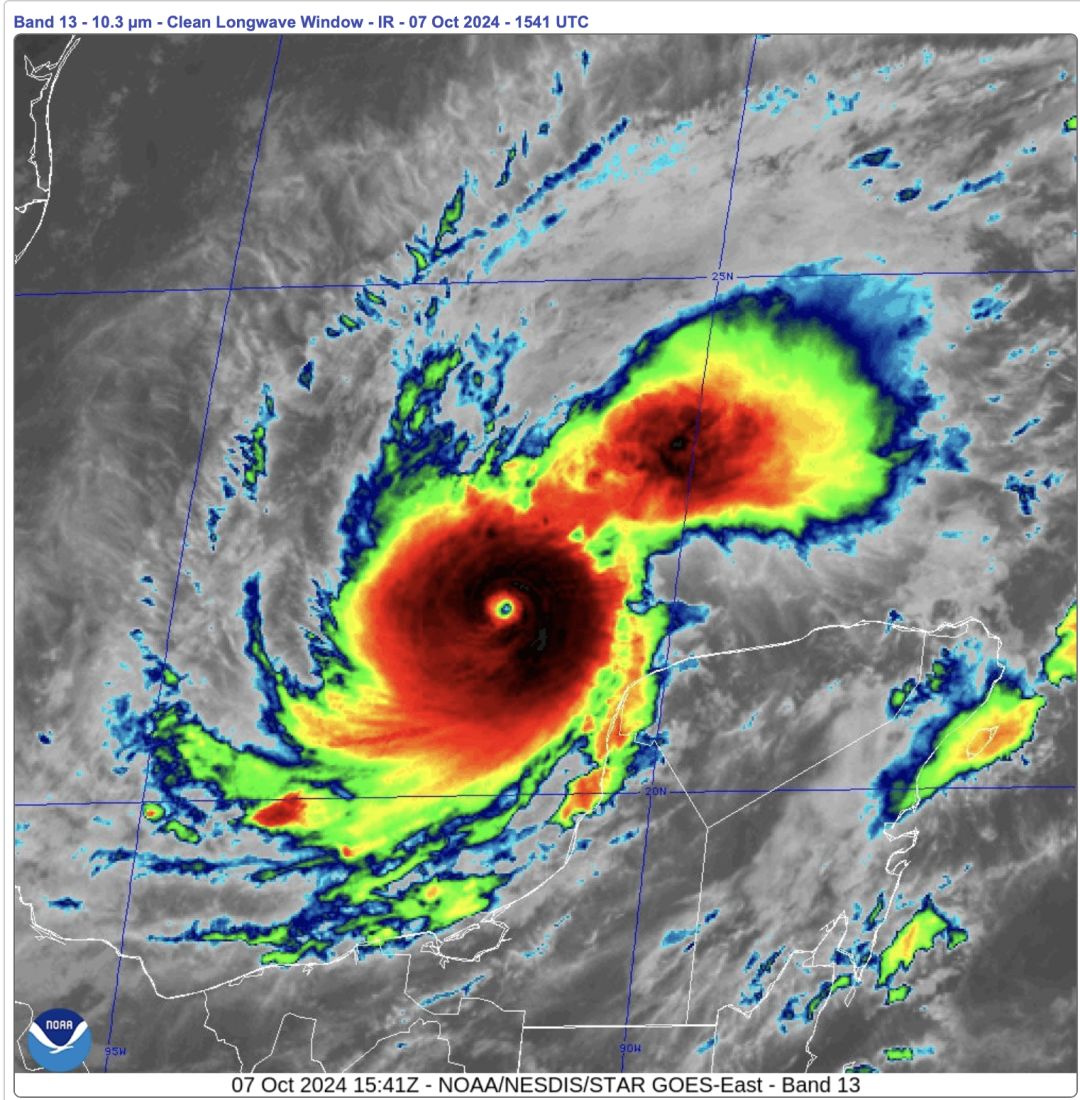
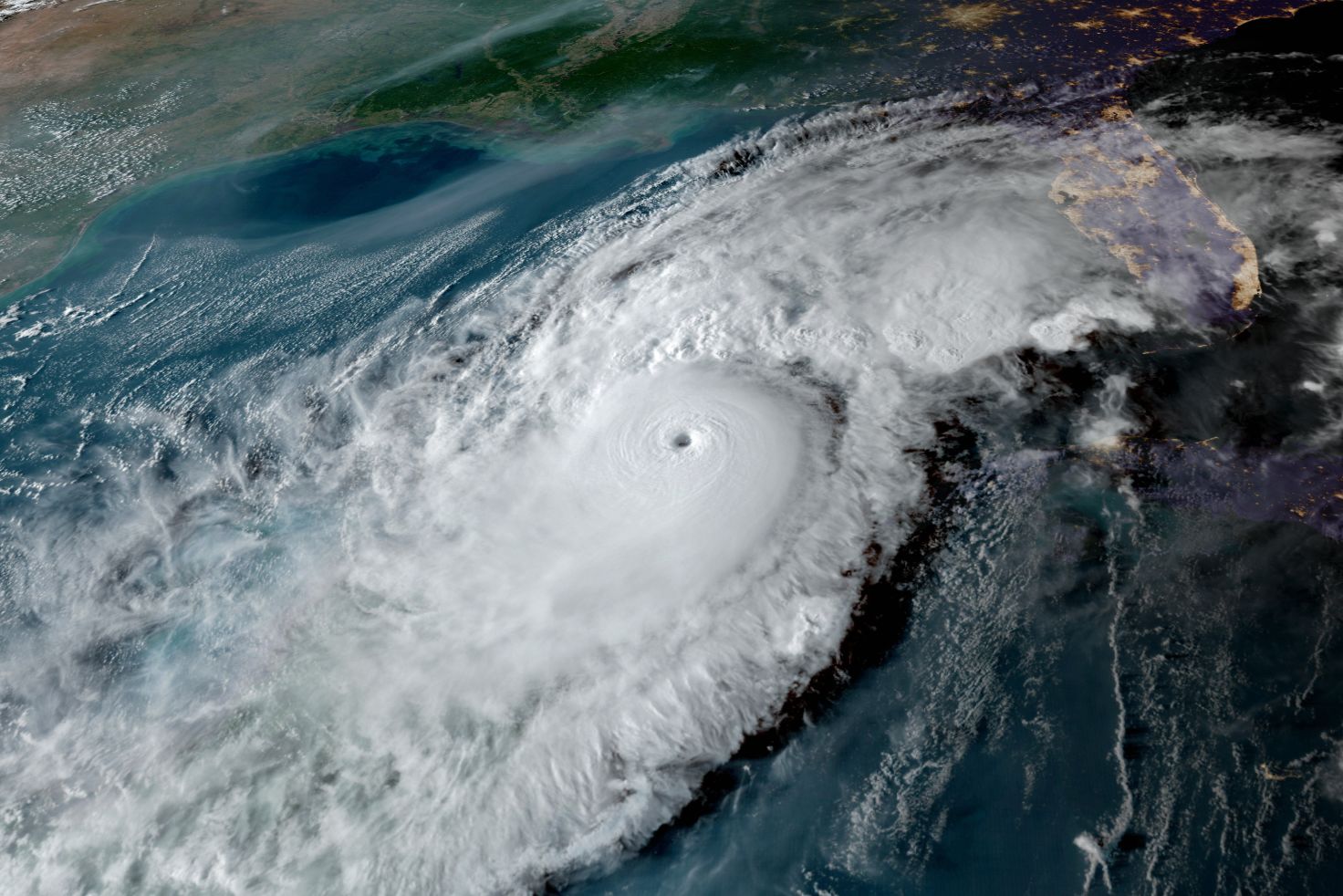
Image: Courtesy Photo
A late satellite image (above) shows how Milton has become a near-perfect signature hurricane. Note the pinpoint eye and the symmetrical, circular shape. This is an energy-eating monster storm, which is why it has intensified so quickly. It was barely a hurricane just 24 hours ago.
A very unusual path is taking shape in which Milton is moving across the Gulf of Mexico, from west to east, over very warm waters in the Gulf and a warm loop current. We are not used to having storms approach the coast from this trajectory, and it makes for both a unique and dangerous situation.

Image: NOAA
The storm will traverse the entire state from west to east as a hurricane. This means damage will be widespread.
Fortunately, there is still time to prepare. It is very important that anything not securely attached be removed and put away so the objects do not become missiles in high winds. Clean your patios, move autos to higher ground and secure any loose debris. You can help ensure your own safety and the safety of others.
Don't wait to evacuate. Remember, many of our evacuation routes have not been raised and will become flooded well before the hurricane arrives.
Know your elevation. If a 12-foot storm surge is forecast and you are at sea level, then you are putting yourself in a lethal situation. Be smart and do the math!
Our communities are mobilizing. Be part of it and take the advice of officials.
Bob Bunting is a scientist, entrepreneur and educator, and the CEO of the nation’s first Climate Adaptation Center (CAC), headquartered in Sarasota. The Climate Adaptation Center is an expert resource to inform government, academe, the private sector and philanthropy so they can create the necessary adaptation strategies and actions to protect the Florida way of life and foster the climate economy while larger global solutions evolve to solve the climate problem. Its fourth annual Climate Conference takes place Nov. 14-15. Contact Bob at [email protected] for more information.