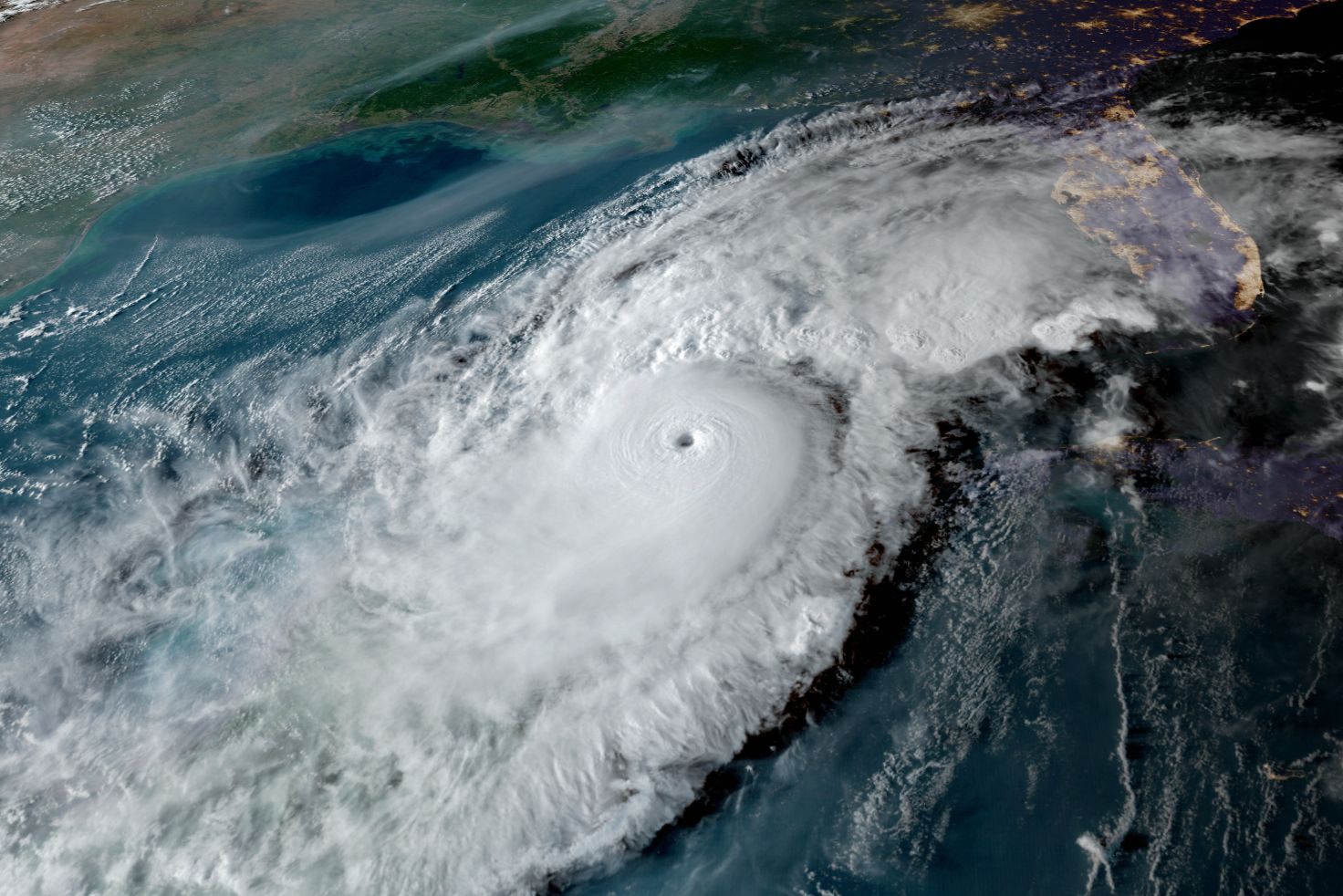
Tropical Storm Debby Will Bring Heavy Rain, Wind and Possible Coastal Flooding to Our Area
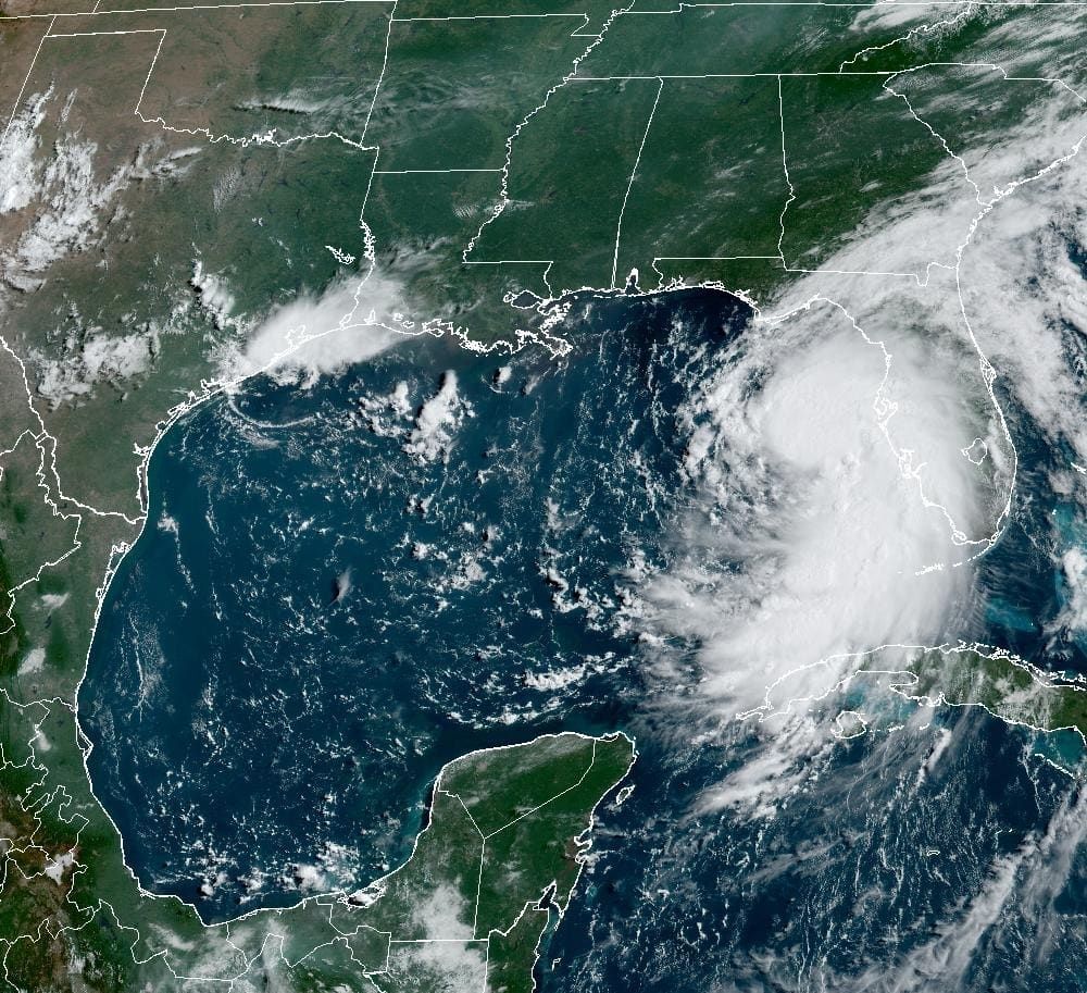
Image: NOAA
In our tropical update posted Friday, I indicated several projections:
- The storm would track along Cuba, which would keep it from developing into a tropical storm until Saturday
- The system would likely become Tropical Storm Debby and track northwestward, off the west coast of Florida, though Sunday
- Debby could intensify more than models forecast because of low wind shear and 90-degree sea surface temperatures
- The storm could stall in Florida's Big Bend of Florida area
- High tides on the Suncoast on Sunday could be high enough to create storm surge and saltwater flooding
- Rainfall would be (at least) 3-5 inches
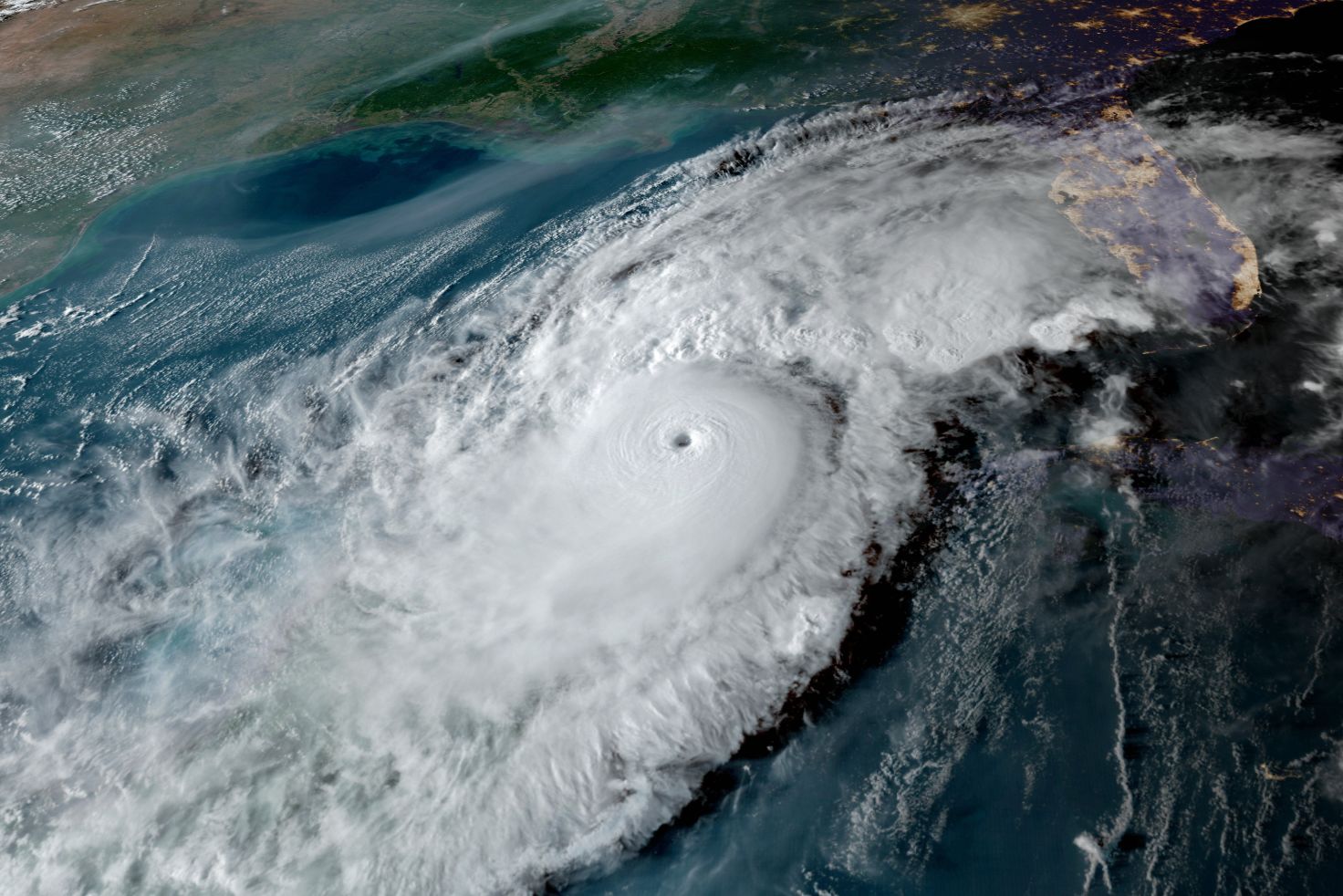
All these early forecasts are coming to pass.

Image: NOAA
Tropical Storm Warnings, Flood and Storm Surge Watches Are in Effect for the Suncoast
Debby is currently a large storm and is beginning to intensify. I expect it may rapidly intensify once it moves north of the Suncoast on Sunday and into Sunday night. Squalls began here on Saturday afternoon and flooding rains will be possible through all of Sunday and Sunday night. Three to 5 inches of rain still seems like a good bet locally, on average—but there could be double that amount in some spots, and northern Florida could get 12 to 18 inches of rain as the storm slows down and comes inland. Yikes!
Be prepared for freshwater flooding from the excessive rains.
Expect Storm Surge Locally
As Debby intensifies as it moves by the Suncoast today, strong south to southeasterly winds will bring high surf and high tides from Bonita beach northward. Two to 4 feet of storm surge is expected here, with potential catastrophic storm Surge of 6 to 10 feet possible in the Big Bend area when Debby makes landfall Monday. By then Hurricane Debby may be strengthening just as it slows down and creeps northeastward across northern Florida.
Because the surge will occur close to high tide, at 12:47 p.m. Sunday afternoon, saltwater flooding will probably occur along the barrier islands in our metro area. Due to long-lasting onshore gale force winds, storm surges and/or coastal flooding may continue into Monday.
Gale Force Winds of 50-60 Miles Per Hour Likely on the Barrier Islands
While storm surge and heavy rains are the main concerns with Debby along the Suncoast, a strengthening storm will mean gale force winds that begin Sunday morning and likely continue into Monday morning. On the barrier islands, from Lido Key northward, 50 mile per hour to 60 mile per hour wind gusts will become onshore as the center of the storm moves to the north. On the mainland, winds should top out at about 50 miles per hour.
Thunderstorms could also create a few tornadoes over western and northern Florida. We're seeing more tornado activity with hurricanes these days.
It’s going to be a long season, so let’s work together to be sure we are prepared.
Bob Bunting is a scientist, entrepreneur and educator, and the CEO of the nation’s first Climate Adaptation Center (CAC), headquartered in Sarasota. The Climate Adaptation Center is an expert resource to inform government, academe, the private sector and philanthropy so they can create the necessary adaptation strategies and actions to protect the Florida way of life and foster the climate economy while larger global solutions evolve to solve the climate problem. Contact Bob at [email protected] for more information.