


A New Tropical System Could Impact the Suncoast Next Week
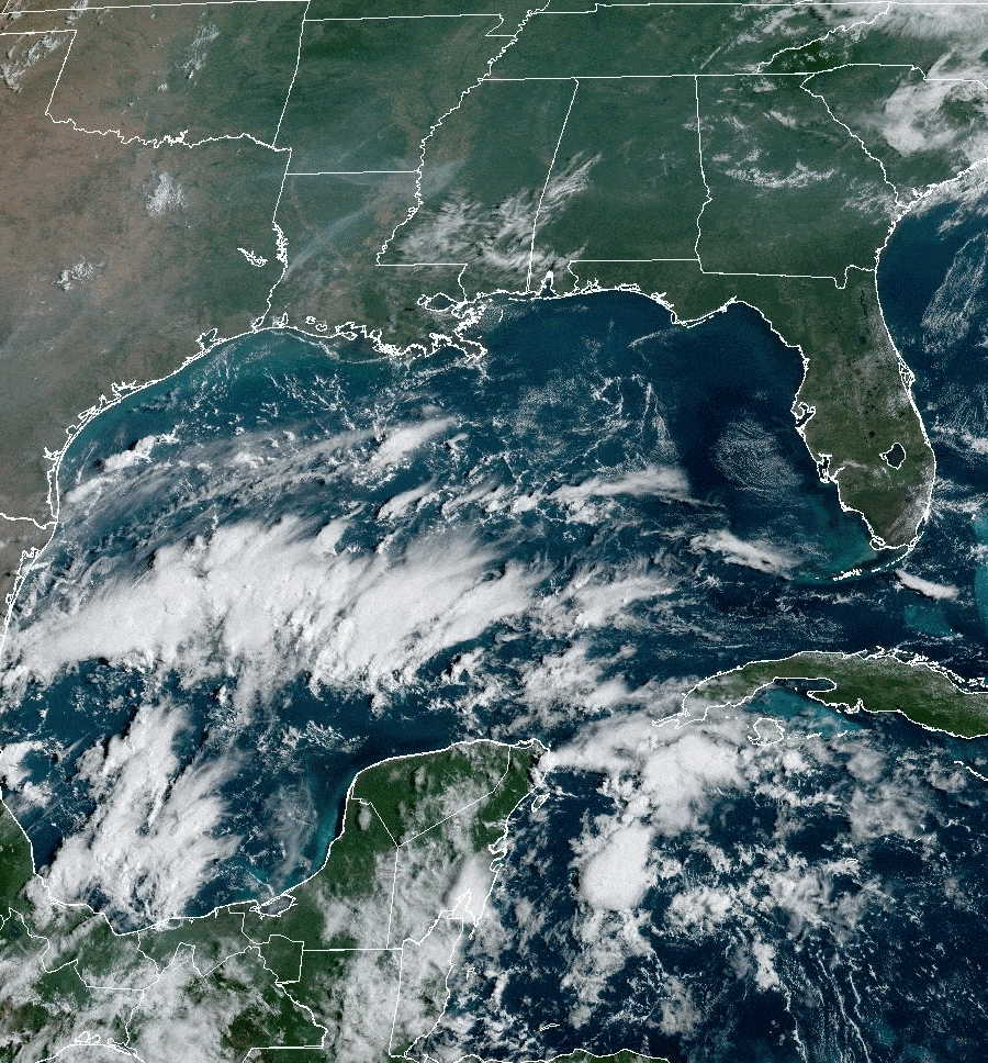
A live look at the tropics as of 2 p.m. on Friday, Aug. 25.
Image: NOAA
Since my report late last week, the tropics have been on fire, with three new named tropical storms and several more that look likely. In my last report, I warned of a possibly historic peak hurricane season. That appears more and more likely.

If this system strengthens into a tropical storm, it could be named Harold.
Image: NOAA
While two of these potential systems are far offshore in the Atlantic Ocean, one of them is more ominous for the Gulf Coast because it's forming in the south Caribbean Sea. Expect a tropical storm to form late this weekend or early next week. The storm could be named Harold. The red circle shows where the cloud mass taking shape.
Sea surface temperatures (SSTs) are near or above record levels in the Gulf of Mexico, and major climate catastrophes are rampant around the world this summer. It's likely a record year for global temperatures, too.
All the heat is causing marine heat waves (MHW), which are excessively hot areas covering broad areas in major bodies of water worldwide. Land-based heat waves are impacting us here in Florida, too, of course.
You already know about the 101.1-degree Fahrenheit SST recorded in Florida Bay recently. Well, looking at the SSTs in the Caribbean and Gulf of Mexico this morning—and the potential path of this new tropical storm or hurricane—means that it's time to pay attention. High SSTs are major fuel for hurricanes.

The tropical system's cloud mass takes shape.
Image: NOAA
The red areas are SSTs above 86 degrees Fahrenheit. The yellow X marks the center of the forming system, and the oblong, light orange area is the potential area for movement over the next five to seven days.
While formation is only at a 30 percent chance today, I believe it's almost a sure thing that a named storm forms.
Since the Suncoast is in the potential path, we need to be prepared. What is your elevation? Where will you go if evacuations become necessary next week? Will you move your autos to higher ground? Do you have your important papers packed so you can take them with you? Are you prepared for long-lasting power outages?
Make intelligent, science-based decisions. Protect your property but be sure to protect yourself.
Now Is a Good Time to:
- Consider if you are in a low-lying area and could face high tides and storm surge
- Figure out where you will go if you need to evacuate
- Stock up on water, batteries and essentials now, while you have time
- Above all, get prepared and pay attention to what is going on in the tropics
And Remember:
- Sea levels are already 9 inches higher than they were 50 years ago, so minor storms have bigger flooding impacts
- Escape routes can be vulnerable because roads in many areas have not been raised
- Power can be off for days in some areas, depending on the severity of winds and storm surge. Consider this in your planning
Bob Bunting is a scientist, entrepreneur and educator and the CEO of the nation’s first Climate Adaptation Center (CAC), headquartered in Sarasota. The Climate Adaptation Center is an expert resource to inform government, academe and the private sector so they can create the necessary adaptation strategies and actions to protect the Florida way of life and foster the climate economy as well as larger global solutions evolve to solve the climate problem. For more information, visit theclimateadaptationcenter.org.


