



Will Isaias Impact Sarasota?
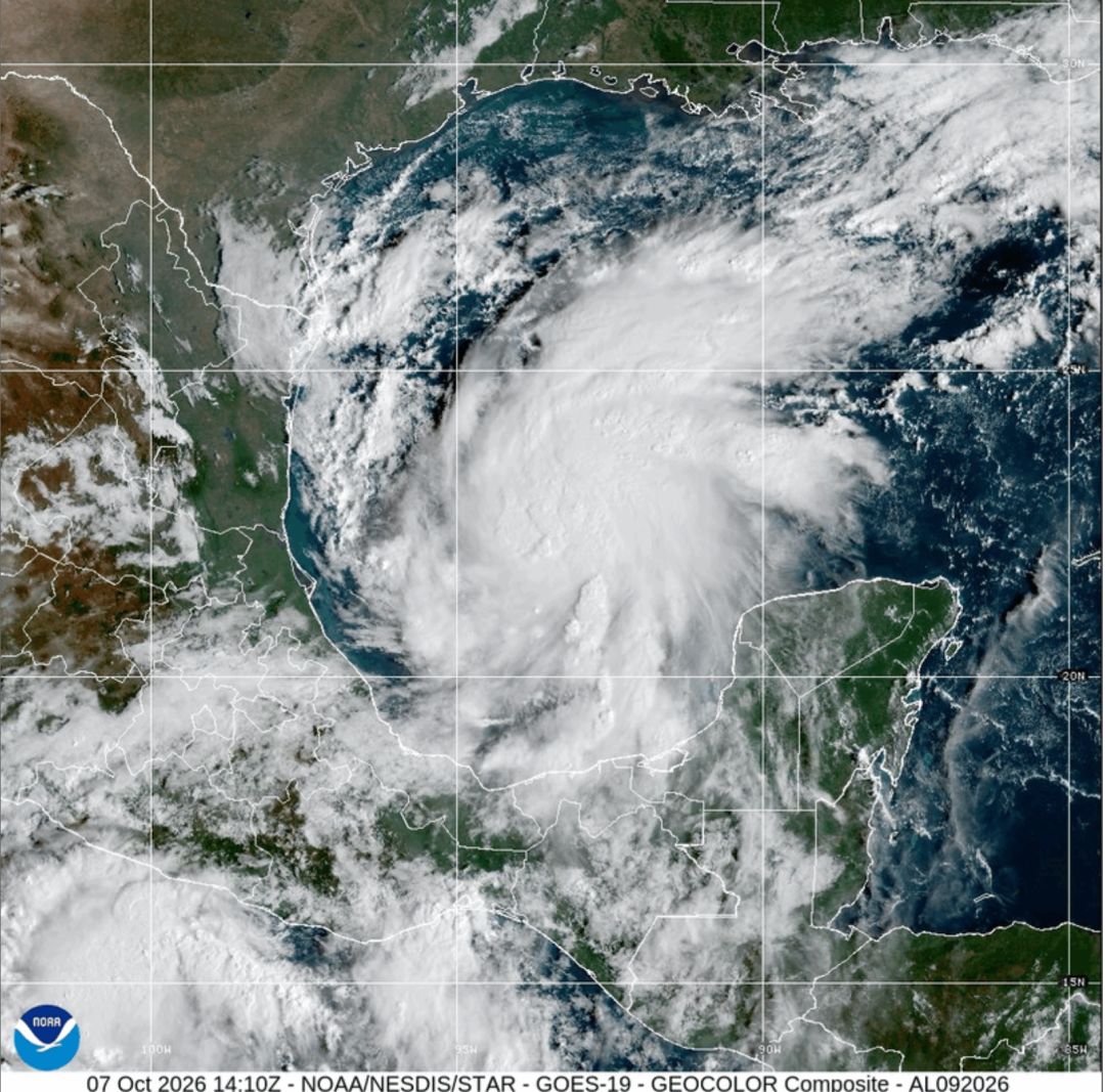
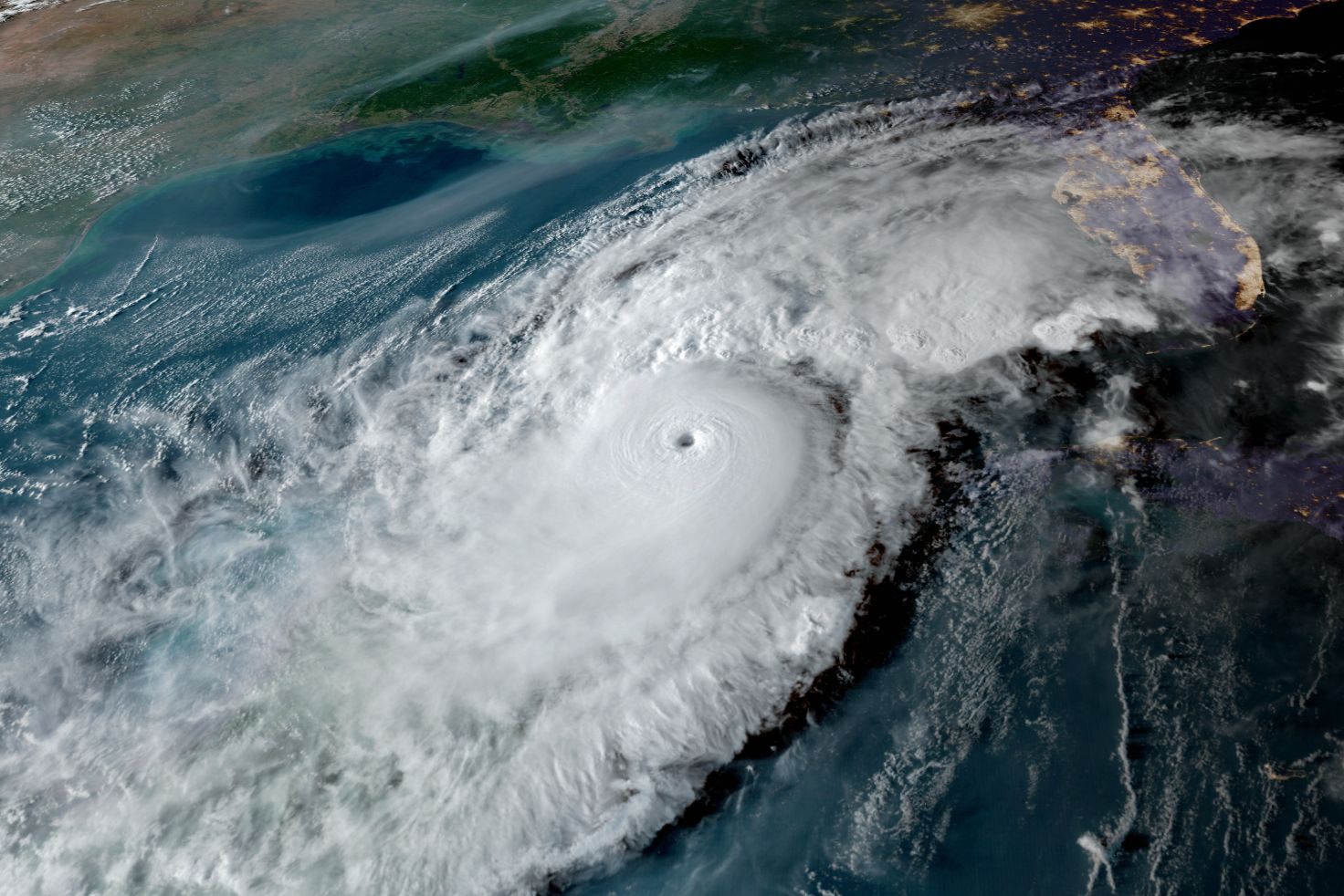
The fifth tropical storm in the Gulf of Mexico this hurricane season is intensifying in the southwest Gulf near where Hurricane Milton formed in 2024. Satellite images and hurricane models indicate the system reached tropical storm strength this morning. The National Oceanic and Atmospheric Administration (NOAA) aircraft flew into the upper level of the storm environment to gather data for model runs just completed and a hurricane hunter aircraft will investigate the storm later today. It is virtually certain now that this system will grow into Hurricane Isaias.
During an El Niño, the usual wind shear can weaken, and a storm can develop and even become a major hurricane. The morning hurricane models with fresh data from the NOAA G5 Gulfstream Jet helped define the system now that a center has formed. With little wind shear and very warm seas near 90 degrees F, the next 36 hours could well include rapid intensification. The present wind patterns suggest a track into the central Gulf with a landfall on the northern Gulf Coast in the Florida Panhandle with big impacts beginning Friday afternoon and continuing though Saturday. The impacts will be greatest from the Florida Panhandle to Louisiana.
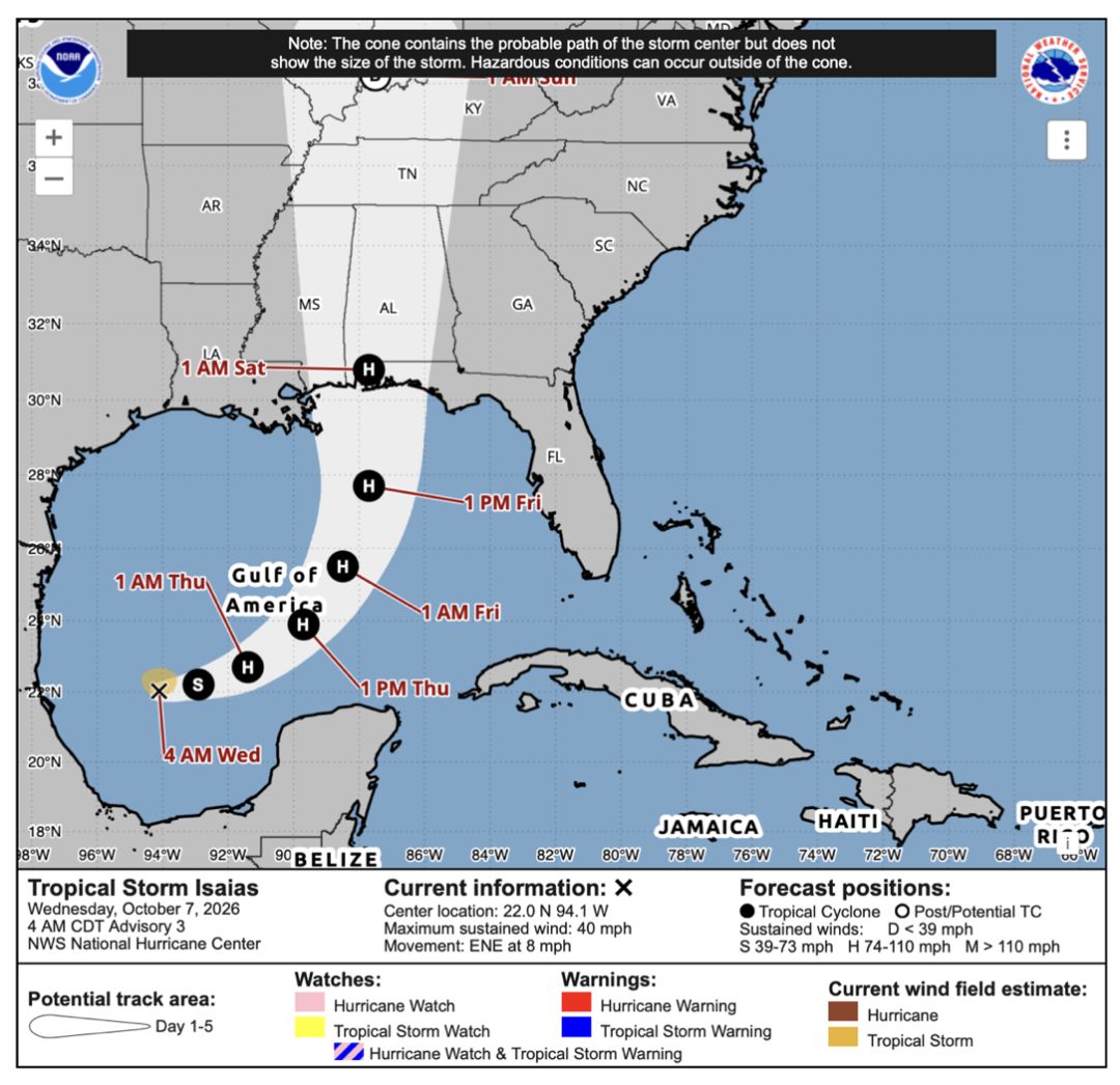
Our best prediction now is Isaias will make landfall as a strong Cat. 2 storm and there is some chance that as it passes well offshore Sarasota it could briefly reach Cat. 3. Warnings should be out soon.
For the Suncoast, the impact will be mostly rain, but we will have to keep an eye on the tides should the storm move closer to the Suncoast and intensify into a Cat. 3. October is the month with our highest natural tides, and high tide on Friday is about 1 p.m. Heavy rains in fall and early winter play a big role in ending Florida droughts and are consistent with strong El Niños. All eight strong El Niños of the past have produced well above normal rainfall in our region. We are seeing this happening now—Sarasota has already had five inches of rain in the past two days.
While 2026 has lived up to Sarasota’s Climate Adaptation Center’s (CAC) prediction that this storm season would be below normal in the number of storms, hurricanes and major hurricanes, most of us would be surprised to learn that the Gulf has actually been more active than last year, which had zero storms.
We’ve had nine tropical storms in the Atlantic Basin, which includes the Gulf, Caribbean and Atlantic Ocean. Even though we are experiencing a rip-roaring El Niño weather pattern, which creates enough wind shear to diminish the strength of storms, three of those tropical storms occurred in the Gulf and they had major impact.
Arthur in mid-June was a catastrophe: 45 mph winds that came ashore near Galveston, Texas, then drowned the western Gulf with nearly 30 inches of rain in portions of Louisiana, a 1-in-1000-year rainfall event. Dozens of tornados occurred and four people died, with damages of more than $1 billion. Bertha was next in late July. It created significant storm surge with landfall in western Louisiana. The surge did tens of millions in damage. In early September, Edouard hit Louisiana again with 60 mph winds and 18 inches of rain that did major flooding and tens of millions of additional damages. As of this morning, Isaias looms.
I am speculating that because the Suncoast was bombarded by the storms of 2024, people think we have had our turn, so the 2026 storms have gone practically unnoticed here. But we should be paying close attention. Even tropical storms can do significant damage in the age of sea level rise and super precipitation events made worse by a warming climate.
Interestingly, in the last 10 years, four major hurricanes starting with "I" have directly hit the Gulf states with a huge toll in human life and property damage. If you need reminding, here’s the list.
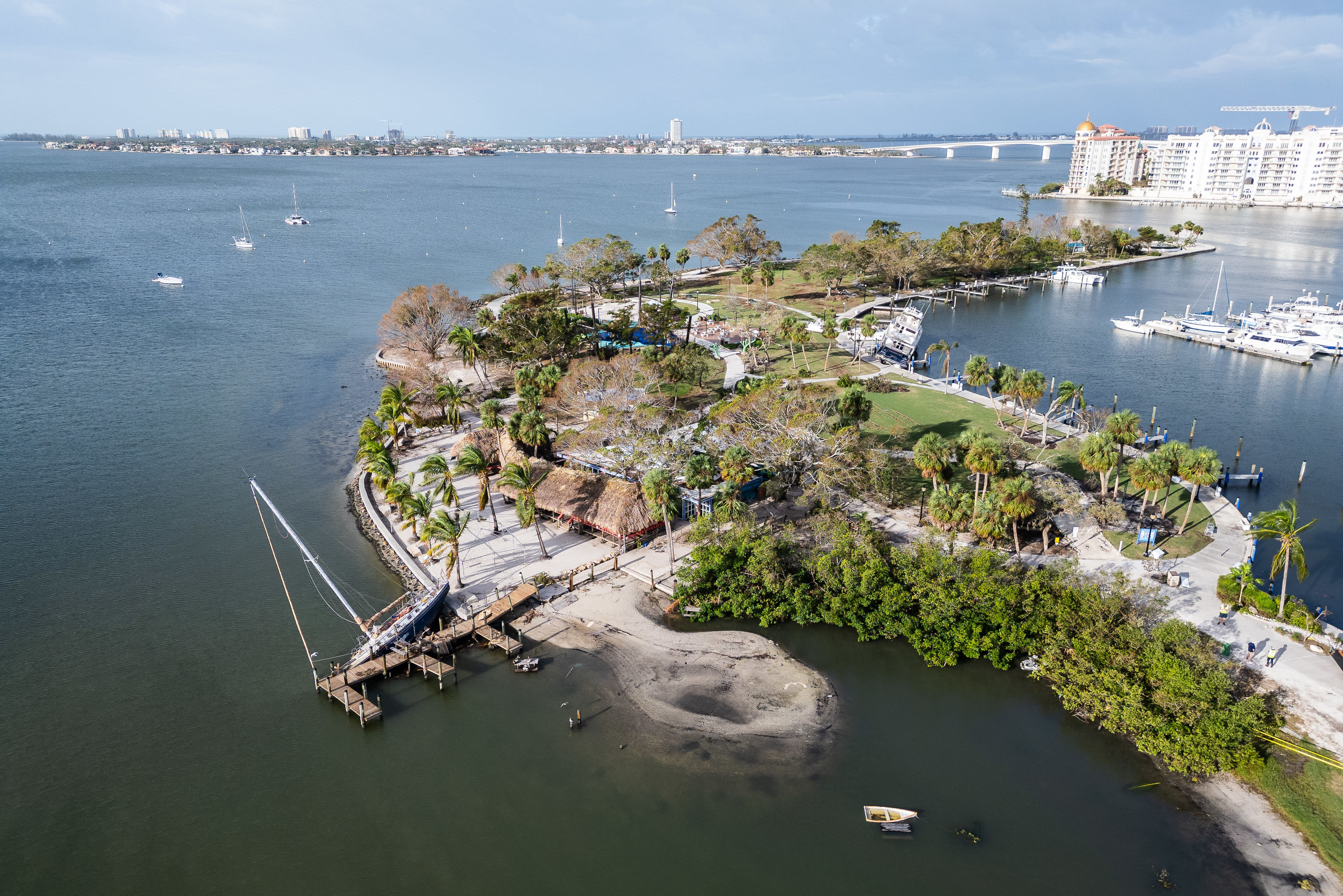
Irma (2017), a Cat. 4 at Florida landfall, ran though the Florida Keys and then up the southwest coast of Florida before moving inland near Marco Island and northward though the spine of the state. Who can forget the massive damage and watching Sarasota and Tampa bays draining out as strong easterly winds raged for two days?
Ida (2021), a Cat. 4, devastated southeast Louisiana.
Ian (2022) was a near miss for us and came ashore at Cayo Costa near Fort Myers. This Cat. 4 devastated a good portion of Southwest Florida.
Idalia (2023) was an important lesson for the Suncoast. A Cat. 3 moving 150 miles offshore Sarasota, it still created major storm surges along our barrier islands before going ashore at Keaton Beach in the Big Bend area of Florida.
Just remember—a non-hurricane in a warmer climate can cause flooding and storm surge made worse by rising sea levels. No matter what, be prepared. And, as a community, we can plan, too.
In fact, the CAC will be launching its new initiative, The Living Lab for Coastal Resilience, at its sixth annual Florida Climate Conference Thursday, Nov. 12, 9 a.m. to 4 p.m. at Selby Auditorium, 8350 N. Tamiami Trail (formerly the University of South Florida Sarasota-Manatee campus). We want the lab to scientifically monitor our coast and help us better prepare for changing climate and weather conditions. General admission is $109; student admission is $55. To register go to theclimateadaptationcenter.org.
Robert Bunting is the founder and CEO of the Sarasota-based Climate Adaptation Center and has been monitoring hurricanes and climate patterns, including as a weather scientist and lead forecaster for NOAA, for 50 years.