Tropical Depression 14—Which is Forecast to Become Hurricane Milton—Is Forming in the Gulf

Image: NOAA
Sit up and pay attention!
I indicated yesterday that new tropical system would form in the southwest Gulf of Mexico this weekend—and indeed, Tropical Depression 14 has formed. It will likely become a major hurricane (Category 3 or higher) in the Gulf of Mexico and approach the Suncoast with the potential of a direct hit on Wednesday.
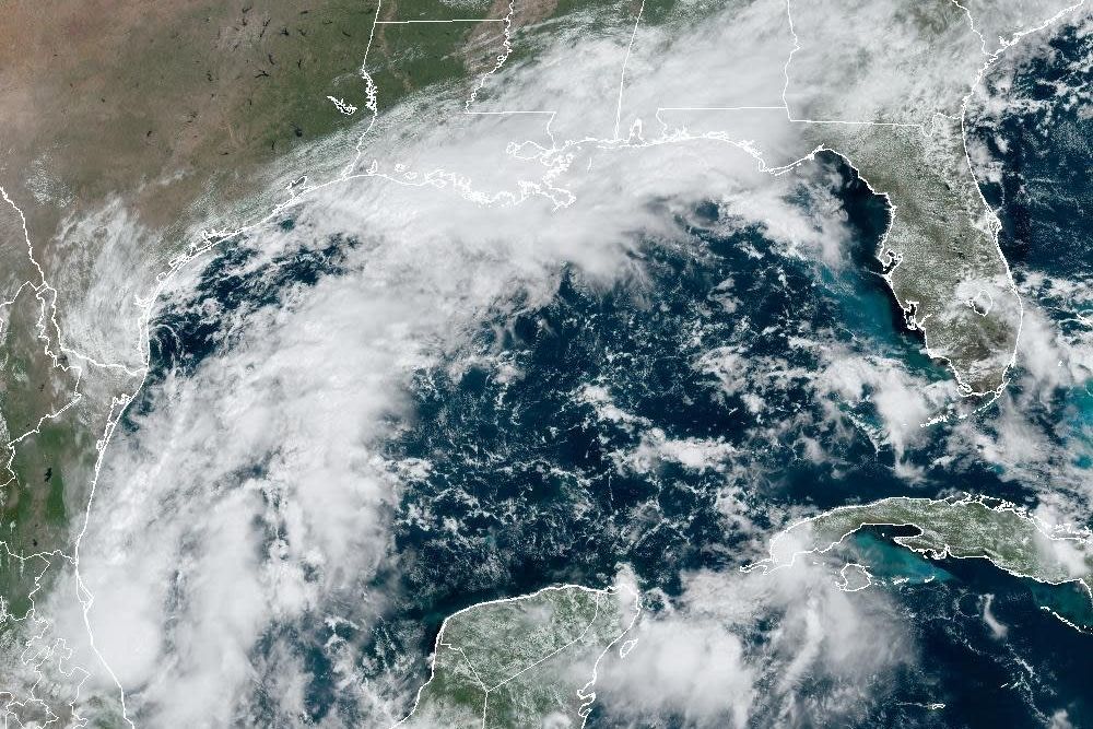
This Saturday morning, visible satellite image shows Tropical Depression 14's organization in the southwest Gulf. I am impressed with the speed at which it is organizing.

Image: GOES Satellite Image
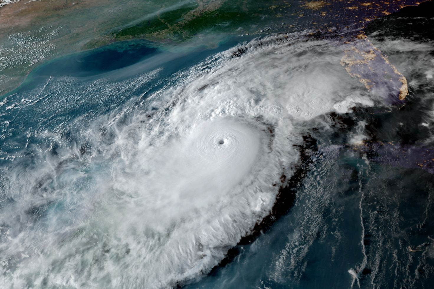
The situation is explosive—and only tempered a bit by the passage of Hurricane Helene a week ago. That storm churned up the Gulf waters so the sea surface temperatures (SSTs) are lower. That said, they are still in the mid-80 degrees, and that is what is needed for major hurricane development.

Image: Courtesy Photo
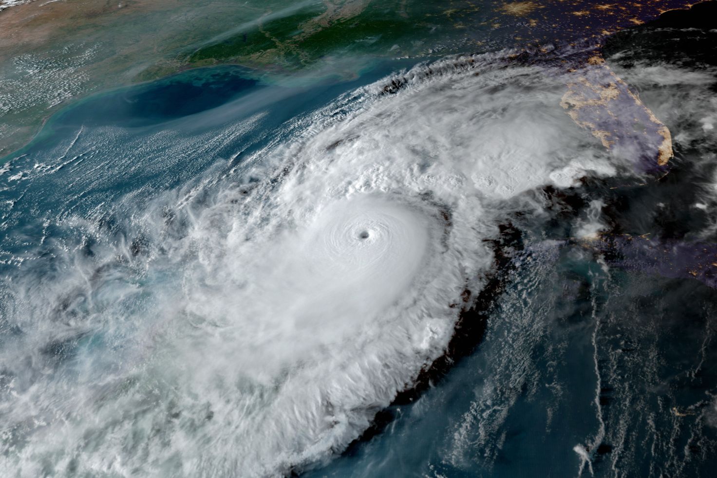
The heat content of the water is shown in the image below; yellow, orange and red are abundant heat content indicators. This means the sea water is very warm not only on the surface, but also to a depth of several hundred feet.
The red arrow shows the general direction of anticipated storm movement. It appears Milton will travel over the loop current—a bubble of very warm water—that can add surprising intensity to a storm approaching Florida's west coast. Hurricane Ian traveled over a similar environment just before reaching Category 5 status.
A La Niña is also just arriving in the Pacific Ocean. That generally means low wind shear in the Gulf. When wind shear is low, storms can stack up vertically as they form, allowing them to efficiently covert heat into rain, wind and lower central pressure in the eye.
Add to that mix upward vertical motion over the Gulf and abundant mid-level moisture and you can understand why this is a potent situation with grave potential.
A frontal boundary along the northern Gulf will likely keep Milton tracking northeast. This trajectory keeps the storm over water for about the maximum possible time before landfall, giving it ample time to strengthen.

Image: NOAA
The National Hurricane Center has released this "cone of uncertainty" for Milton; here is the forecast as of this morning. Anyone in the cone could have a direct hit. People outside the cone can still have serious impacts—as we learned this year from Hurricane Helene and Hurricane Debby. And this storm has the potential to be worse than those as far as impacts on the Suncoast.
For these reasons—and because the numerical weather models have under-forecast intensification this year, I believe the likelihood of a major hurricane is high.
I hope I am wrong.
Bob Bunting is a scientist, entrepreneur and educator, and the CEO of the nation’s first Climate Adaptation Center (CAC), headquartered in Sarasota. The Climate Adaptation Center is an expert resource to inform government, academe, the private sector and philanthropy so they can create the necessary adaptation strategies and actions to protect the Florida way of life and foster the climate economy while larger global solutions evolve to solve the climate problem. Its fourth annual Climate Conference takes place Nov. 14-15. Contact Bob at [email protected] for more information.