Hurricane Ian Will Likely Make Landfall in Sarasota County as a Category 3 Hurricane
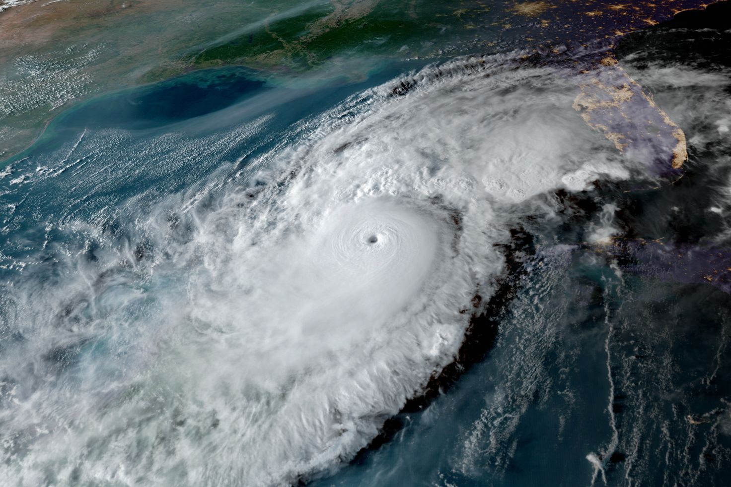
Hurricane Ian as of 11 a.m. on Sept. 27, 2022
Image: NOAA
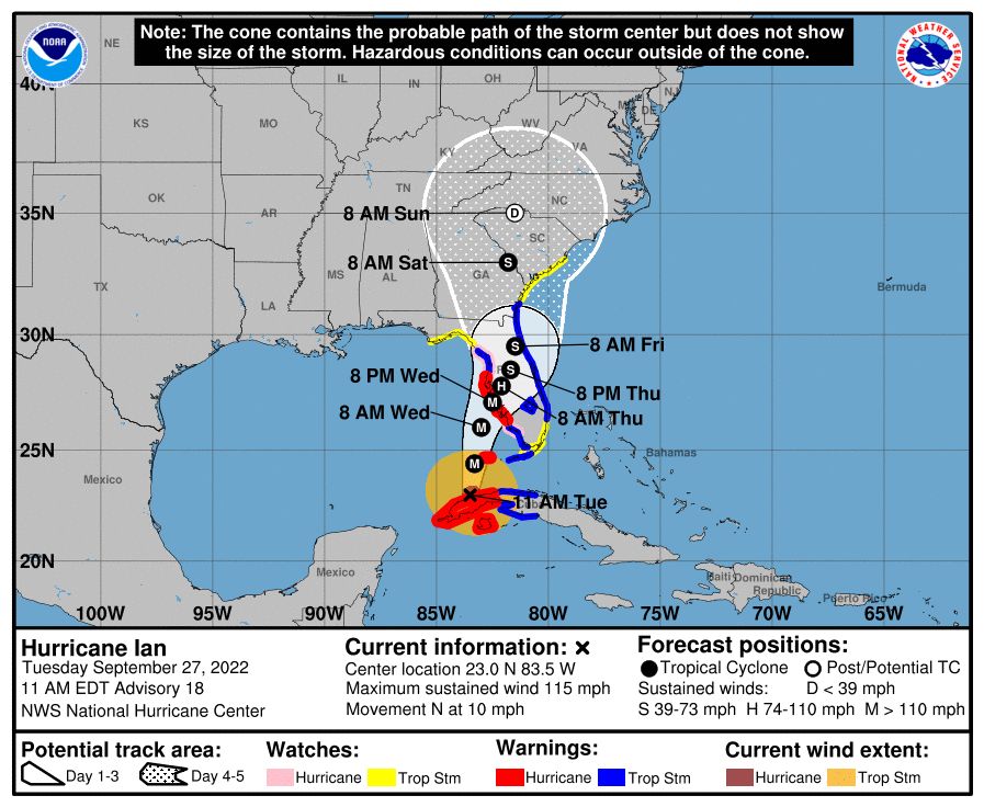
Probabilities are now high that Ian, now a Category 3 hurricane, will make landfall on the Suncoast. The critical times will begin before sunrise Wednesday morning as gale-force winds and heavy rains move into the area.
Hurricane conditions are probable Wednesday night into Thursday as the storm slows down its forward speed just before landfall.
High winds—above hurricane-force—and storm surge to the south of the center of the storm will pass though much of the area. Peak storm surge is predicted be in the 5 ft. to 10 ft. range, from the middle of Longboat Key northward to Tampa Bay, and slightly less in the Sarasota metro area.
Peak winds at the center of the storm will likely be in excess of 100 mph at the time of landfall. The storm may reach Category 4 status for a short time while approaching the Gulf Coast, but wind shear will be increasing as it does and should mean there will be some slight weakening before landfall.
Very heavy flooding rains are also likely, with 6 to 10 inches in most places but up to 20 inches in others.
The storm's slow movement will mean two days of tropical storm or higher conditions.
This is the time to listen very carefully to evacuation orders. Remember, the power grid will be damaged, electricity will go off and roads will quickly become dangerous to navigate.
Make intelligent, science-based decisions. Protect your property, but be sure to protect yourself.
Now is a good time to:
- Consider if you are in a low-lying area and could face high tides and storm surge.
- Figure out where you will go if you need to evacuate.
- Stock up on water, batteries and essentials now, while you have time.
- Above all, get prepared and watch what is going on in the tropics.
And remember:
- Sea levels are already 9 inches higher than they were 50 years ago, so minor storms have bigger flooding impacts.
- Escape routes can be very vulnerable because roads in many areas have not been raised.
- Power can be off from days to weeks in some areas, depending on the severity of winds. Consider this in your planning.
Bob Bunting is a scientist, entrepreneur and educator and the CEO of the nation’s first Climate Adaptation Center (CAC), headquartered in Sarasota. The Climate Adaptation Center is an expert resource to inform government, academe and the private sector so they can create the necessary adaptation strategies and actions to protect the Florida way of life and foster the climate economy as well as larger global solutions evolve to solve the climate problem. For more information, visit theclimateadaptationcenter.org.