Ian Is Now a Hurricane; Heavy Impact to the Suncoast Is Likely
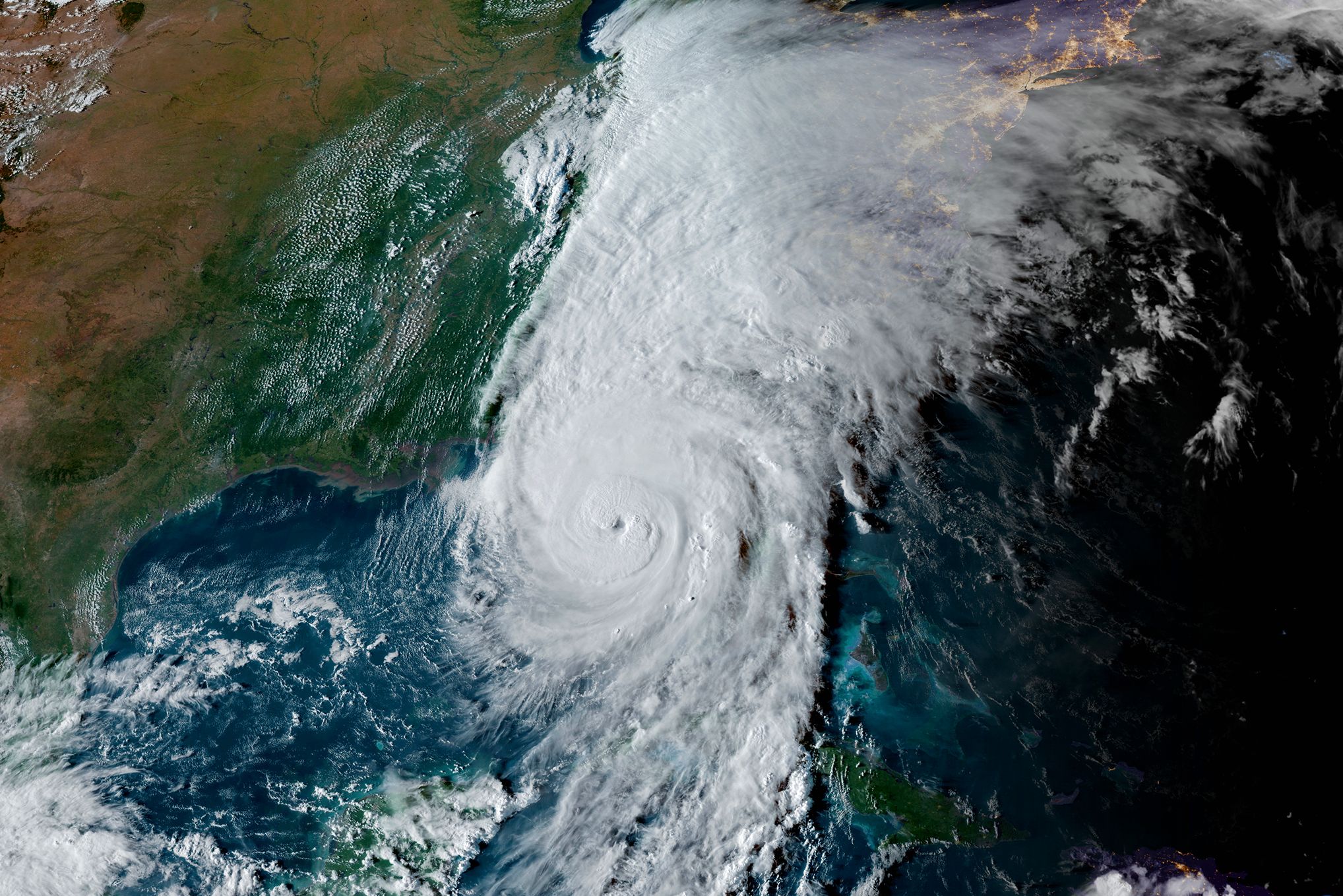
Ian is now crossing almost directly over the Cayman Islands, and probabilities of a damaging hit to the Suncoast are increasing. The storm is now a Category 1 hurricane. I expect explosive development as wind shear is low and sea surface temperatures are in the mid- to high 80s.
A hurricane watch is in effect for all of the Suncoast, including Tampa, Bradenton, Sarasota and Venice.
For days, I've been trying to communicate that this storm looks like one to remember. Now it's getting organized and is taking a near-perfect position to make landfall or move parallel along the coastline—bringing the worst impacts of this storm on or very close to heavy population areas.
All preparations should be completed today. Ian's main threat will be from Wednesday into Friday.
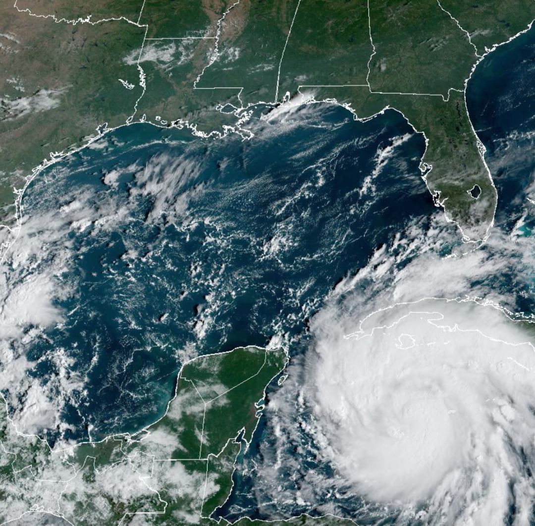
The path of the storm is now becoming clear, but there is still some doubt about whether its eye will stay off the coast, skirt the coast or move inland around our area. Still, it looks like any of these scenarios will likely bring hurricane-force winds to a portion of our area.
Here is the latest path projection.
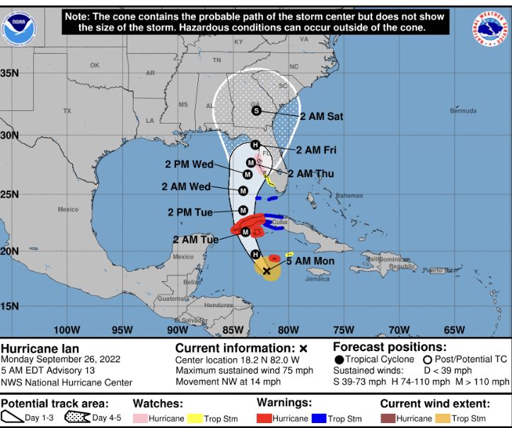
Image: NOAA
The Climate Adaptation Center has been warning that hurricanes will be more severe, closer to the coast of western Florida and slower-moving than in the past due to a warming climate.
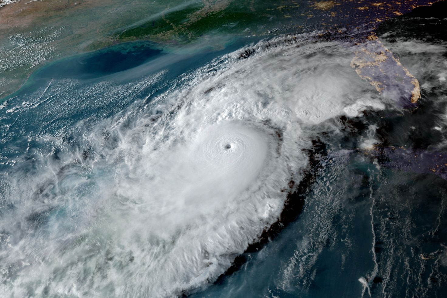
Ian is forecast to exhibit all these characteristics. The storm will most likely attain Category 4 status just south of our metro area. It will also slow down as it approaches, so the period of heavy impact will be extended.
As the system moves northward north of Sarasota, wind shear will pick up and the system will begin loosing strength.
Remember, this is a dynamic situation and the worst impacts are still several days away. That is why we all must be on top of this situation, be prepared for the worst and hope for a better evolution of the system than now looks likely. Make intelligent, science-based decisions. Protect your property, but be sure to protect yourself, too.
Now is a good time to:
- Figure out whether you are in a low-lying area and could face high tides and storm surge
- Figure out where you will go if you need to evacuate
- Stock up on water, batteries and essentials now while you have time
- Above all, get prepared and keep a close eye on what is going on in the tropics
And remember:
- Sea levels are already nine inches higher than they were 50 years ago, so minor storms have bigger flooding impacts
- Escape routes can be very vulnerable because roads in many areas have not been raised
- Power can be off from days to weeks in some areas, depending on the severity of winds. Consider this in your planning.