Sarasota Magazine 513 Central AveSarasota FL 34236
Tagged
Hurricane Season
Use Sarasota and Manatee counties' interactive tools to find evacuation levels and routes, shelters and more.
08/28/2023 By Megan McDonald
Government
The FMP is being updated early to better align with the county’s Local Mitigation Strategy (LMS), which helps to prevent or minimize future emergency flood impacts.
06/17/2021 By Staff
Meetings
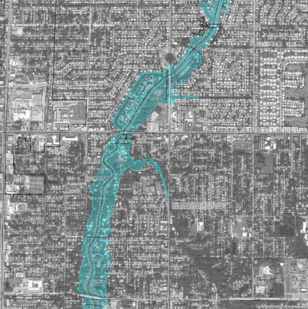
The open houses aim to help residents review Preliminary FEMA Flood Insurance Rate Maps (FIRMs).
02/24/2020 By Staff
Map It Out
Szucs maps out rivers and watersheds with bright colors.
11/13/2019 By Shelby Schwartz
Planning
Sarasota County will host six open houses to address changes to the Federal Emergency Management Agency's floodplain maps, which take effect Nov. 4.
06/06/2016 Research by staff
Article
Our interactive guide to Sarasota and Manatee food trucks.
04/01/2013 By Megan McDonald