


It's Quiet in the Tropics Right Now—But Probably Not For Long
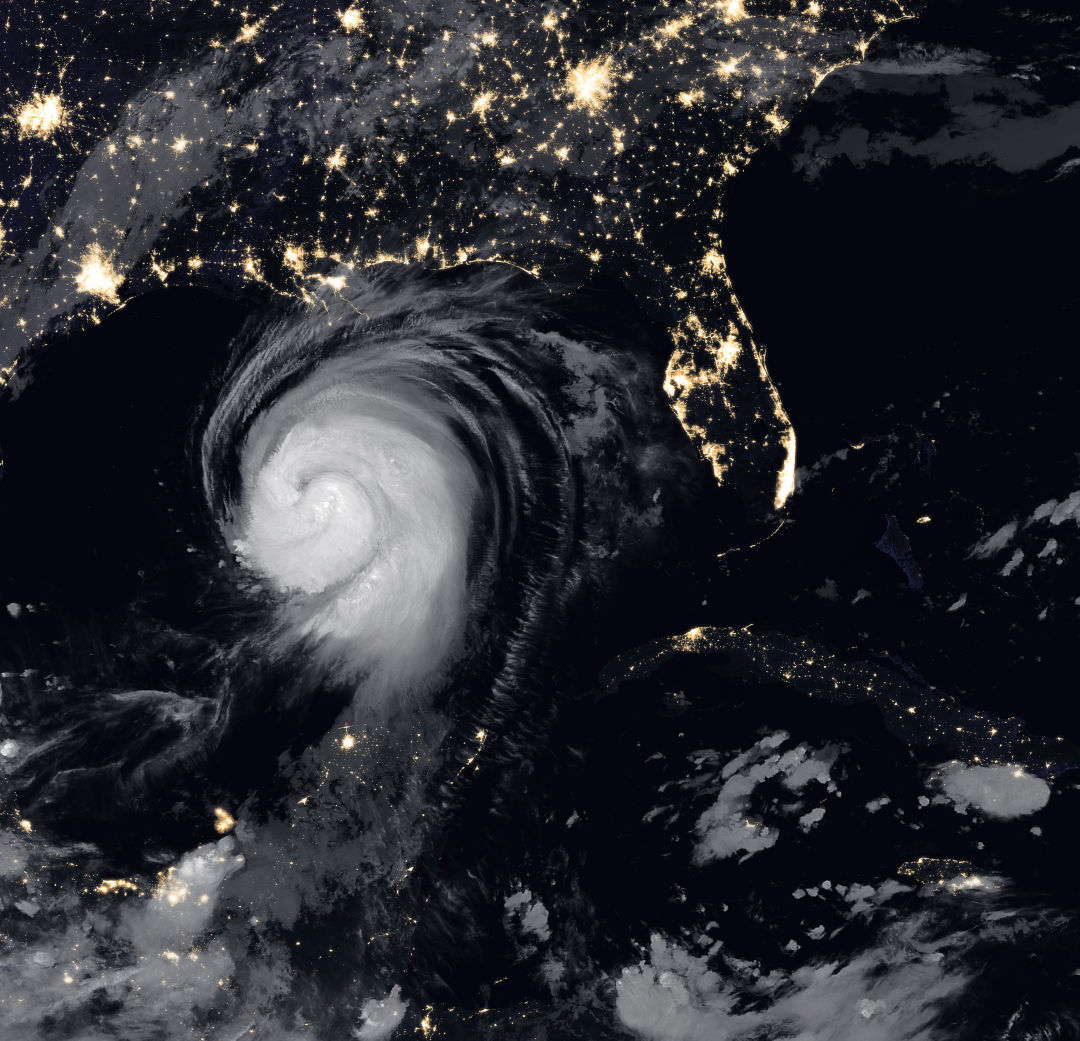
Hurricane Laura
Image: NASA
This year's hurricane season has set records so far with nine storms—six of which hit U.S. coastlines, including Hurricane Laura, the fastest-developing storm in history.
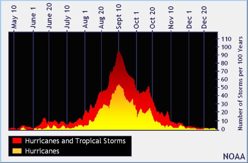
Currently, as September transitions to October, there is a lull in hurricane activity—that's likely to last another week or so before a second burst of tropical storm activity begins and the season shifts from the Atlantic to the Caribbean and the Gulf of Mexico. This pause in storm activity isn't unusual; the season's peak is traditionally in mid-September, with a second peak in mid-October.
However, this part of the season is a very dangerous time for hurricane impacts on the west coast of Florida. Case in point: Wilma in 2005 and Michael in 2019, both Category 5 storms.
In late spring and in October, in particular, tropical systems often form in the Caribbean Sea, off the coast of the Yucatan Peninsula and Central America. These storms often move northward into the Gulf of Mexico, where they become "landlocked" and thus have to make landfall somewhere along the Gulf Coast.
A look sea surface temperatures (SSTs) over the years.
Image: Courtesy Photo
Additionally, and importantly, sea surface temperatures (SSTs) are close to maximum levels, as Gulf waters have had all summer to heat up. This year is no exception, with most of the Gulf reporting SSTs in the upper 80 degrees F range, and even above 90 degrees F in some locations.
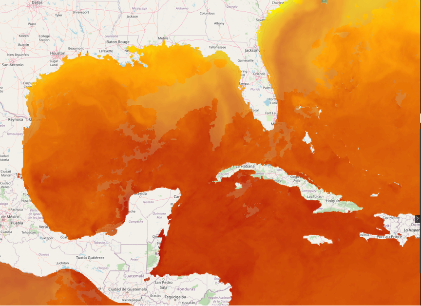
Today's satellite sea surface temperatures (SSTs).
Image: Courtesy Photo
The deep red color in today’s satellite SSTs, pictured above, are temperatures above 86 degrees F, which is a critical value for potential explosive intensification should a storm form in these areas in the coming days.
Add to these ingredients the fact that a La Niña event is now underway in the Pacific, and the recipe for an October to remember in the Gulf of Mexico is nearly ideal. La Niña is when cool Pacific Ocean waters impede wind shear in the Gulf of Mexico. Wind shear is a negative for hurricanes because it prevents them from becoming vertically stacked. But with less or no wind shear in La Niña situations, these storms can build up vertically in a way that allows them to become super hurricanes.
There are some initial indications that the lull in hurricane season could end during the first week in October. With such a tumultuous season in the books so far, now would be a good time to review your plans and be ready for the most dangerous month for hurricanes on the west coast of Florida.
To learn more, click here.
Bob Bunting is a scientist, entrepreneur and the chief executive officer of Sarasota’s Climate Adaptation Center, an expert resource for government, academia and the private sector to create the necessary adaptation strategies and actions to protect Florida’s way of life. The center provides support for the emergence of the climate economy and is currently raising $2 million in private donations to kick off its mission.