More Than 50 Inches of Rain Have Fallen in Sarasota Over the Past Three Months
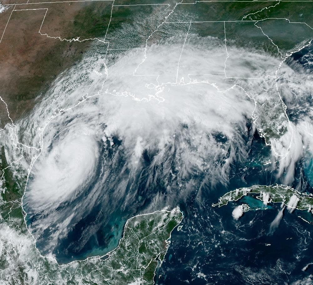
Image: NOAA
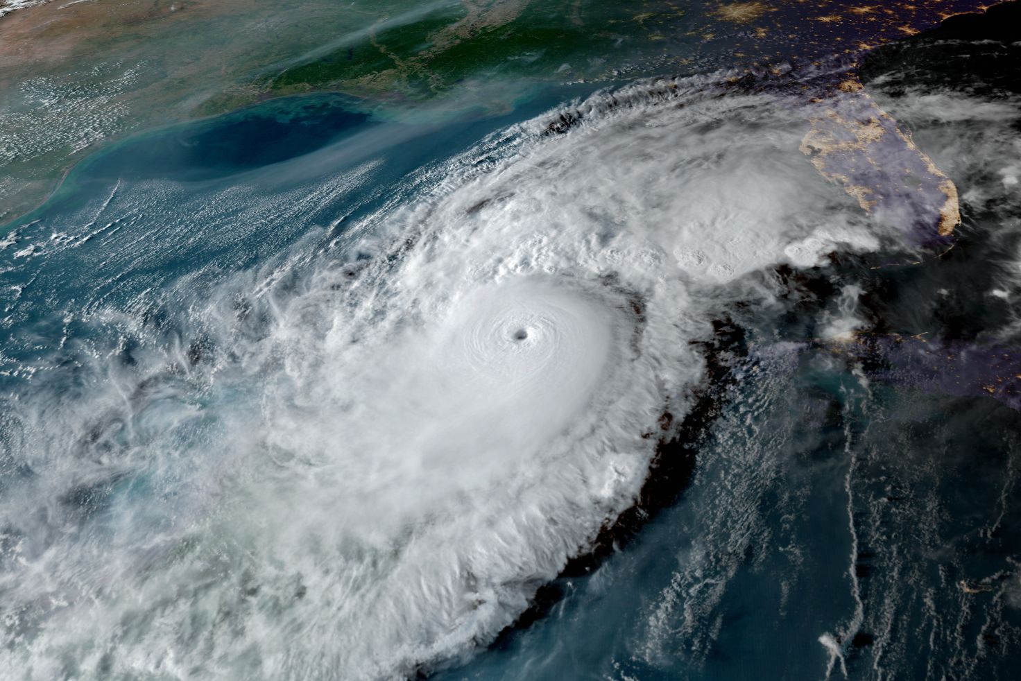
Hurricane Francine formed in the southwest Gulf of Mexico on Monday, breaking a five-week lull in the hurricane season. Given that lull, we now anticipate a total of 12–14 named storms this season, with 7–8 hurricanes and 4–5 major hurricanes.
Between the Climate Adaptation Center, Colorado State University and NOAA, experts predicted a bad hurricane season. We're at the halfway point now, and six storms have formed. Each one has been impressive in some aspect, and every one has hit land. Hurricane Francine will continue this pattern—this time along the Texas, Louisiana and Mississippi coastlines.
Also like many recent storms, Francine may undergo rapid intensification. When it reaches the coastline, its eye will likely pass over Louisiana, potentially as a high-intensity Category 2 storm, but with an outside chance of becoming a Category 3 within the next 24 hours.
Some areas are expected to receive over a foot of rain, with flooding from 5 feet to 10 feet of storm surge. Heavy rains and surges will combine, creating another major impact on a coastline already ravaged by seven storms since 2017.
Here is the latest information on Francine as of this afternoon.
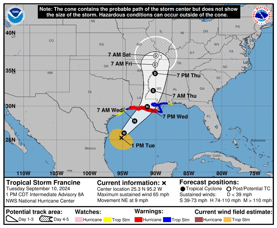
Image: NOAA
Now, a few words on the lull we've experienced since Hurricane Ernesto.
The three main predictors of an active hurricane season are warm ocean temperatures, abundant moisture in the mid-levels of the atmosphere, and weak vertical wind shear (often seen during La Niña conditions).
In the CAC's hurricane season forecast on April 4, after detailing the ideal conditions for hurricane formation (as outlined here), I noted two factors that could potentially reduce the number of storms this season.
Saharan Dust
All the ingredients are in place for a big hurricane season in 2024. But what could reduce the threat? One of the hardest things to predict is how much dust will blow out of the Sahara Desert and into the Atlantic. In previous years—including last year—this dry air has kept storms at bay for weeks. If it happens again, it could help suppress storm activity this season.
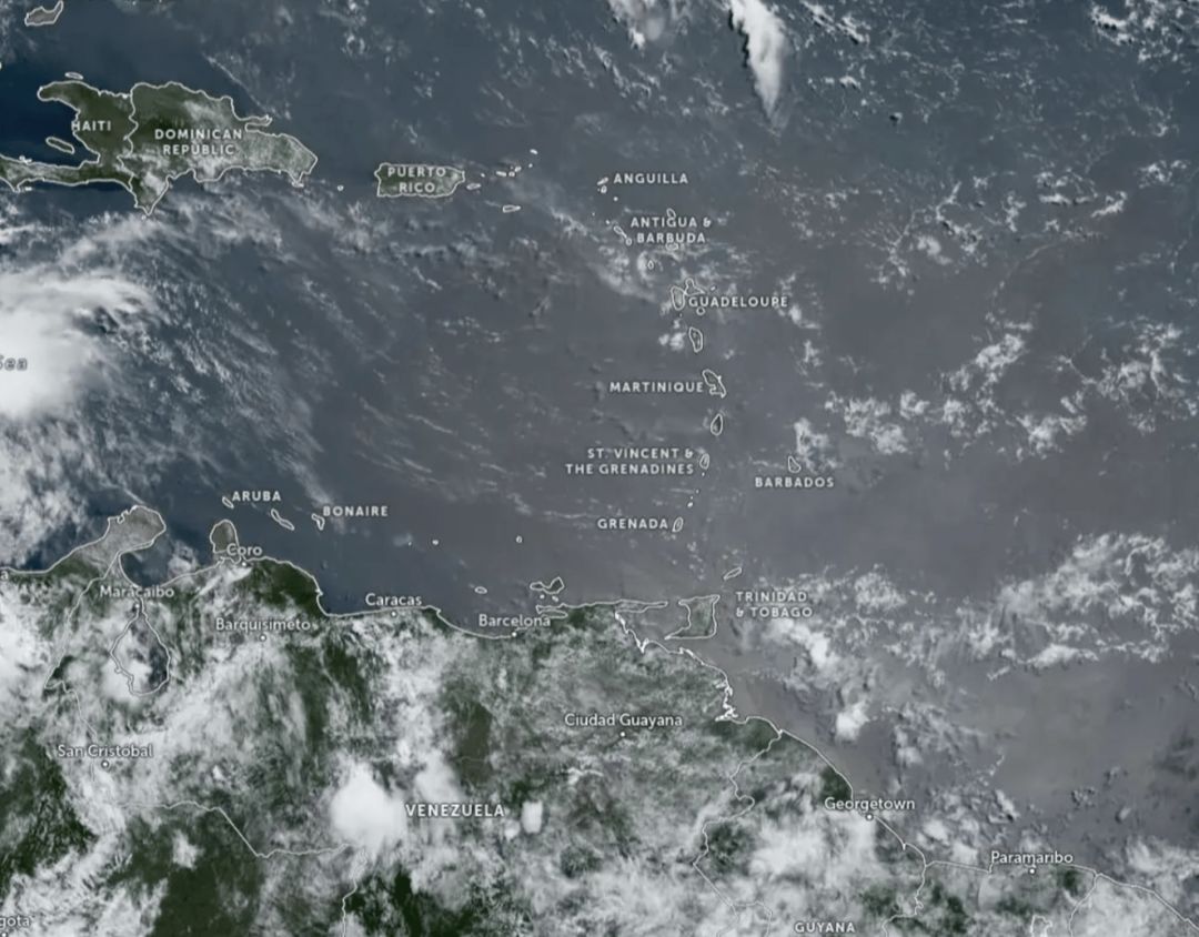
Image: Courtesy Photo
African Easterly Waves
These are typically enhanced clusters of showers that move eastward across the southern part of central Africa, eventually emerging into the Atlantic Ocean near the Cape Verde Islands. During La Niña conditions, these waves tend to be less frequent. When that occurs, hurricane formation off the coast of Africa decreases, while more storms form further west, near the West Indies, Caribbean, and Gulf of Mexico tends to increase.
Indeed, that is exactly what has occurred, with a very strong African monsoon becoming the third factor. No doubt you've heard about the intense flooding and storms in the Sahara. Because the monsoon shifted so far north, the easterly waves also moved north, where they entered the Atlantic into cooler waters.
These factors would have suppressed a typical hurricane season, but not this one. Our 2024 storms formed further west, with most developing in the western Caribbean and Gulf of Mexico, just as the CAC predicted.
Hurricane Beryl formed in June, becoming the earliest Category 5 storm ever recorded in the Atlantic, and it devastated the power grid in Houston. Hurricane Debby was enormous, dumping up to 20 inches of rain in parts of Florida and wreaking havoc all the way to Canada, resulting in over $15 billion in property damage.
For those of us on Florida’s west coast, September and October are critical months as storms shift from forming off the coast of Africa to developing in the western Caribbean.
Image: Courtesy Photo

Image: Courtesy Photo
As we move into peak hurricane season, here's what I can share about the remainder of the season: Dust in the Main Development Region of the Atlantic and Caribbean is diminishing, and the tropics are becoming more active. Record sea surface temperatures and the emerging La Niña pattern suggest that the second half of the season will likely be active.
Francine, our fourth hurricane, may become the second major storm of the season before making landfall tomorrow. We’ll know more in the next 24 hours. Additionally, there are two other systems between the Cabo Verde Islands and the Windward Islands that have a good chance of becoming named storms in the next week. If they do, they will be named Gordon and Helena. And then, of course, there's the dreaded 'I' storm—this year, it’s Isaac. You'll remember—even though you probably want to forget—that since 2017, we've experienced the wrathof Irma, Ian and Idalia, and of course we won't forget the unnamed tropical system on June 11 or the recent damage from Debby.
We've seen more than our fair share of water, with more than 50 inches of rain in Sarasota over the past three months—a record. In fact, we've experienced several record-breaking events on the Suncoast in just the last two years:
- Hurricane Ian: A 500-year inland flood and historic storm surge in Ft. Myers
- Hurricane Idalia: Significant saltwater storm surges from Venice to Tampa
- Unnamed Tropical System (June 11): A thousand-year rain event for Sarasota
- Hurricane Debby: A 200-year freshwater flood event
These climate-induced events have taken a devastating toll, claiming scores of lives and causing hundreds of millions of dollars in property damage.
We must remember that it's not the number of storms that matters, but the impact of each one. As we've seen, it only takes one major storm to make a significant difference. The welcome break appears to be over and it’s time to pay attention again.
Bob Bunting is a scientist, entrepreneur and educator, and the CEO of the nation’s first Climate Adaptation Center (CAC), headquartered in Sarasota. The Climate Adaptation Center is an expert resource to inform government, academe, the private sector and philanthropy so they can create the necessary adaptation strategies and actions to protect the Florida way of life and foster the climate economy while larger global solutions evolve to solve the climate problem. Its fourth annual Climate Conference takes place Nov. 14-15. Contact Bob at [email protected] for more information.