Tropical Depression Fred Is Heading Our Way
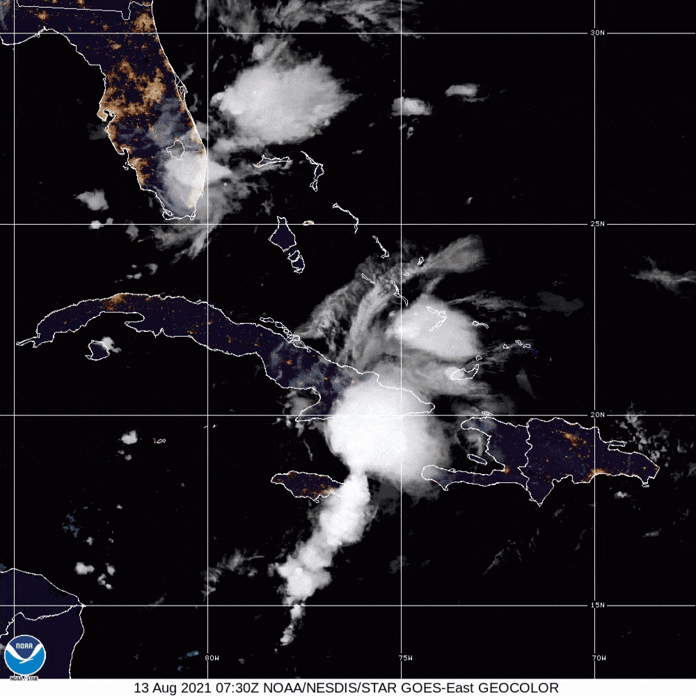
Tropical Depression Fred, as of Friday morning.
Image: Courtesy Photo
The August through October peak hurricane season is just starting, and already we’ve had seven named storms.
On Friday morning, Fred was a tropical depression headed toward the west coast of Florida over the next few days. At the same time, another new tropical depression is forming in the eastern Atlantic between West Africa and Puerto Rico. I believe this system will become Tropical Storm Grace over the weekend. While Fred will affect our area, it is too early to tell if Grace will.
First up is Fred. After buffeting Hispaniola with heavy rains and gales, Fred departed in a weakened state, since the mountains disrupted the circulation of the storm and weakened its structure. Moderate wind shear is also helping to keep the system weak at present. But as the system moves into the warm waters north of Cuba and though the Florida Straits, it should become somewhat better organized. Tropical storm strength should be regained in the next day or so, as it slowly moves toward the Florida Keys.
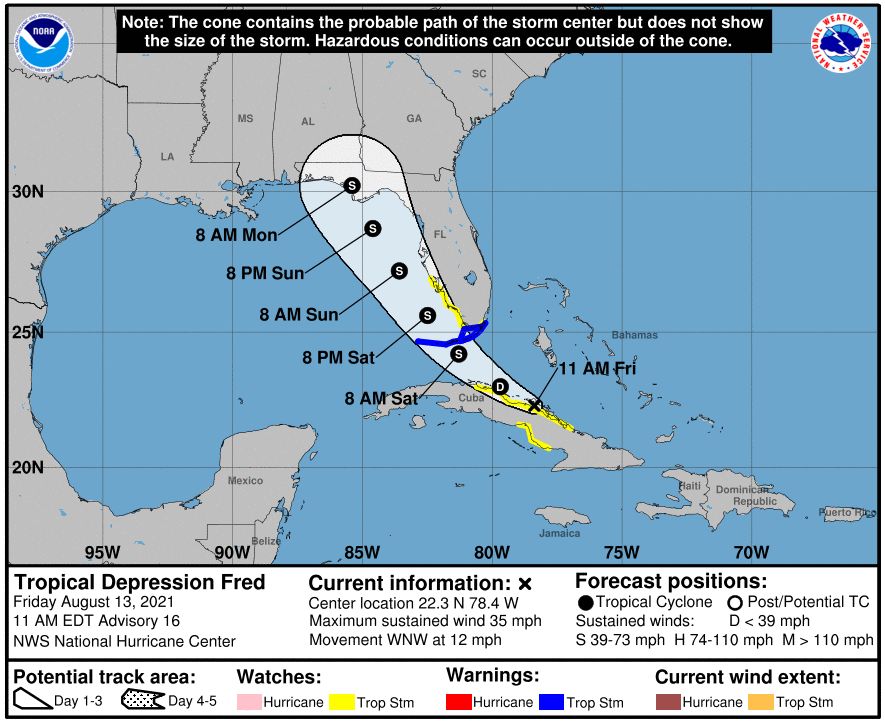
A National Oceanic and Atmospheric Administration graphic showing the expected path of Tropical Depression Fred.
Image: Courtesy Photo
Although moderate wind shear will be a deterrent, sea surface temperatures in the eastern Gulf are hovering around 87 degrees Fahrenheit. Water temperatures at this level are very supportative of tropical storms and hurricanes. Tropical storm warnings are out for the Florida Keys and a tropical storm watch is in effect from just south of the Sarasota area to the Keys. Watches and potential warnings are likely to be extended northward along the west coast in the next 24 hours.
Models are forecasting a path very similar to Hurricane Elsa, and I expect this storm to be weak as it approaches the Sarasota metro area Saturday afternoon and Saturday night. Heavy rains and gale force winds are still possible.
Since tropical storms have a counterclockwise circulation, gales from the east will likely precede the storm’s passage. These winds will be strong enough to blow red tide blooms and may enhance the bloom already fueled by Elsa and the Piney Point disaster. In addition, the expected rainfall is in the 3-inch to 5-inch range and runoff of nutrient-rich water from the Florida mainland into the Gulf may fertilize the bloom.
So far, we are on track for 20 named storms in 2021, as predicted in the Climate Adaptation Center’s first hurricane season forecast, issued on April 15. Next week, the Climate Adaptation Center will issue its peak hurricane season updated forecast; that will be available on the center's website.
On Friday, Nov. 19, at Selby Auditorium at the University of South Florida Sarasota-Manatee, the Climate Adaptation Center will host its second climate conference. The Florida Future Climate Conference will deliver climate forecasts for 2030, 2040 and 2050. Tickets will go on sale in mid-September for this event.
Atmospheric scientist Bob Bunting is the chief executive officer of Sarasota’s Climate Adaptation Center.