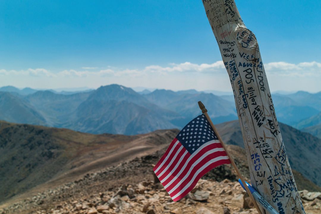
Know Before You Go: A Complete Guide to Hiking 14ers Near Aspen
You’ve heard of 14ers—mountains that rise above 14,000 feet in elevation? They’re kind of a big deal in Colorado, home to more of them than the rest of North America combined. Here in Aspen’s Elk Mountains are seven spectacularly beautiful ones that, collectively, might be the hardest to climb in Colorado. To some, that may be a turnoff. We get it. We suggest warming up first by hiking up a gentler Sawatch Range 14er like Mount Elbert or La Plata Peak. On the other hand, if the prospect of an engaging climb and a summit well earned revs your outdoor engine, we couldn’t recommend the Elks more, even if you’re not a hard-core mountaineer. With some preparation and smarts, you’ll come away richer for the experience. Gear up well, get an early start, and know your route. In these pages, you’ll get an idea of what the standard routes entail, learn more about each peak’s appeal, and read first-person anecdotes from locals about their experiences—both good and bad. Of course, we strongly recommend hiring a local guide service to ensure a safe ascent. Happy climbing!
Go-to Guides
The definitive guidebook is Gerry Roach’s Colorado’s Fourteeners: From Hikes to Climbs, 3rd edition. Other books include The Colorado 14ers: The Standard Routes, from the Colorado Mountain Club, and Dawson’s Guides to Colorado’s Fourteeners, written by Carbondale mountaineer Lou Dawson; the latter is out of print but used copies are available on Amazon. Find topographical maps for the Elk Mountains and beyond at the Ute Mountaineer in Aspen and at Bristlecone Mountain Sports in Basalt.
Aspen's two local guiding services offer trips up area 14ers led by professional, certified guides. Aspen Expeditions offers custom trips. In addition to custom itineraries, Aspen Alpine Guides also offers Leave the Boys Behind women’s trips on August 26 (Mount Massive); September 9 (La Plata); and September 23 (Castle Peak).
Pro Tips
Being fit is a prerequisite for mountain climbing. But you can also be extremely fit yet still suffer from altitude sickness—some people’s systems just don’t tolerate high elevation very well. Signs that you’re getting altitude sickness: headache, nausea, dizziness, shortness of breath. What to do? Go back down! Tagging the summit is never as important as maintaining your health. Altitude sickness can progress to high-altitude pulmonary or cerebral edema; both can be deadly if untreated.
Always check the weather before you go, says Stephen Szoradi of Aspen Alpine Guides. Anticipate afternoon thunderstorms, and try to get off ridgelines by 11 a.m., if possible. If you do get caught out in bad weather above treeline and lightning is close, head down the mountain as quickly as you can. If flashes are close by, crouch down. Don’t touch nearby trees or rocks, as they can conduct electricity, and don't seek shelter under large trees.
Classes of 14ers
Climbing/mountaineering routes are graded by difficulty on the following scale 1-5:
Class 1: A walk in the park, relatively speaking
Class 2: Be ready for some off-trail hiking over talus or scree, and maybe even some simple scrambling over larger rocks.
Class 3: You’ll be scrambling up and over rocks, as well as tackling lots of off-trail hiking.
Class 4: Climbing skills come in handy, as you’ll be challenged by some potentially daunting rocks on steep, exposed terrain; some people even choose to use a rope.
Class 5: Bust out the technical rock climbing gear unless your name is Alex Honnold (Don’t know him? He just became the first person to free solo Yosemite’s El Capitan.)
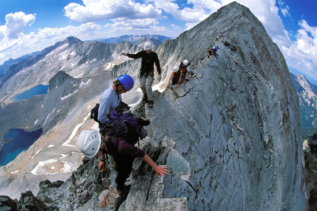
David Shinn nears the summit of North Maroon.
Image: Dan Bayer
The Maroon Bells
North Maroon Peak
Height: 14,019 ft
Rank among Colorado 14ers: 52
First ascent: August 25, 1908 by Harold Clark and Percy Hagerman
Standard route length: 8 miles round-trip
Vertical: 4,450 ft
Difficulty: Class 4
Maroon Peak
Height: 14,163 ft
Rank among Colorado 14ers: 25
First ascent: August 28, 1908 by Percy Hagerman
Standard route length: 10 miles round-trip
Vertical: 4,600 ft
Difficulty: Class 3
You’ve seen them many times before. You’ve likely sat beneath an image of them at a local restaurant. They may even be on your bank card. They’re the world-famous Maroon Bells—the most photographed peaks in North America. Sure, the view of the Bells reflected in the placid waters of Maroon Lake is one of America’s great vistas, but there’s scads of awe-inspiring scenery around here. What is it about these distinctive, triangular-shaped mountains that requires stringent traffic and crowd-control measures to keep the area from being overrun? If you’ve hiked near Maroon Lake, you may have seen the plaque warning of the “Deadly Bells.”
That’s not hyperbole; climbers have been hit by falling rocks or plummeted to their doom after losing their footing in the wrong spot. As the plaque notes, “The rock is downsloping, rotten, loose, and unstable. It kills quickly and without warning.” Trust us, these suckers are not to be taken lightly. Despite regulated access (only buses, not cars, are allowed on the road from 8 a.m.–5 p.m. in summer), casual tourists and hardcore mountaineers alike continue to journey to Maroon Lake and beyond for one simple reason: The Maroon Bells have come to define Aspen, as much as the ski areas and the glitz and the music. This pair of peaks represents the apexes of physical beauty, adventure, and challenge (and, no, they don’t ring). Quite simply, you can’t say you’ve really been to Aspen until you’ve at least seen the Bells.
Standard routes:
Tackling the Bells is not for the faint of heart. Unless you’ve got some solid climbing and mountaineering experience, hire a local guide for the adventure.
Maroon Peak, South Ridge: The route heads south from Crater Lake along the West Maroon Trail for about 1.8 miles before heading west up Maroon Peak’s east slopes. From here, the trail gains a lung- and leg-busting 2,800 vertical feet in a mile, crossing loose, scrabbly ledges to reach Maroon’s south ridge. It then follows a well-cairned route along the ridge to reach the summit.
North Maroon Peak, Northeast Ridge: This route parallels Minnehaha Gulch for a half mile before veering left on an unmarked climbers’ trail into the gulch, across the creek, and up the far side. The trail then goes south and traverses the mountain’s northeast ridge to reach a gully on the east slopes. This loose, steep gully and another one just south of it must be ascended to a ridge at 13,200 feet that leads to the summit.
The traverse: Some climbers attempt both Bells in one day, traversing the ridge between them, which can be done in either direction. Going from north to south allows climbers to rappel the most difficult section on a rope. Going the opposite way entails climbing up the most difficult part and affords a shorter descent down North Maroon. No matter what, the traverse is exposed and dangerous; if you’re an experienced peak bagger and game for the challenge, approach it with caution and watch out for potentially hazardous weather.
First-hand account:
Early in my career, and a little earlier in [noted Aspen mountaineer] Ted Mahon’s career, we went up the Gunsight Couloir with improper gear. We were carrying only single mountaineering axes. Ted at least had on a pair of gaiters. I had to use duct tape to keep my pant legs shut and keep the snow out. We quickly realized as we were going up the couloir that it would be a one-way trip. We weren’t going to be able to descend it—at least not without the rope that we were not carrying. We continued wallowing to the summit of North Maroon via the northwest ridge, swimming—literally, at times—through waist-deep and chest-deep snow. We were by ourselves up there, based on the time of year. We descended the standard summer route, which was still covered in lots of snow and rime ice on the rocks. At one point, I was hanging by my fingertips on a little rock ledge, and the wind had sent snow cascading down the slope. We were getting spindrift, and snow was filling our coats and getting in our eyes and covering everything we had. It was definitely a precarious position. —Dirk Bockelman, guide, Aspen Expeditions
Pyramid Peak
Height: 14,025 ft
Rank among Colorado 14ers: 51
First ascent: Aug 31, 1909, by Harold Clark and Percy Hagerman
Standard route length: 6 miles round-trip
Vertical: 4,450 ft
Difficulty: Class 4
The hardest 14er? Ask which Colorado 14er is most difficult to climb by its easiest route, and you’ll get a host of answers. But ask enough folks and one name is sure to come up over and over: Pyramid Peak. From the iconic view of Pyramid up the Maroon Creek Valley, it’s obvious that the peak is steep, but there are steeper 14ers. And at a mere 6 miles round-trip, the standard route is relatively short. But what it lacks in length, the climb more than makes up for in other difficulties. “The Elks are notoriously dangerous, comprised of legendary loose rock,” says Stephen Szoradi, guide and managing partner of Aspen Alpine Guides, “and they can be hit by somewhat unpredictable but very consistent afternoon storms.” Add to that near-vertical Class 4 climbing and fall-and-you-die exposure, and Pyramid has a good case for being the most difficult. Other contenders include North Maroon Peak, where falling rocks in steep gullies are a serious hazard, and Capitol Peak, which puts climbers in some sketchy spots. Outside of the Elks, Little Bear Peak, Crestone Peak, and Crestone Needle, all in the Sangre de Cristos, are known for being steep and exposed. In the San Juans, Mount Wilson and El Diente feature a fearsome traverse, while Sunlight Peak finishes with a steep climb to a summit that’s nothing more than a huge, pointy boulder jutting up into the sky.
Standard routes:
The route begins at Maroon Lake and follows a well-marked trail toward Crater Lake for a little more than a mile, then leaves the main trail to follow a climbers trail up Pyramid’s north slopes to a hanging basin at 11,900 feet. From here, there are two alternatives, one up the northeast ridge, one up the northwest (this route has extreme exposure and can be hard to follow).
Both approaches start with a long, steep uphill climb across loose, unpleasant rock, followed by tricky route finding and Class 4 climbing to the mountain’s imposing north face and up to the tiny summit. In places, one could fall a long, long way down, but taking one’s time and making good decisions keeps the climbing below Class 5.
First-hand account:
My absolute favorite peak in the Elks is Pyramid. I love the approach from below treeline and the ascent to the saddle, where it becomes very clear that this is the place the mountaineering adventure starts. The saddle is also the place where I’ve made some very good goat friends after visiting year after year. Opa is the granddaddy of mountain goats, and we had a face-off one day on what’s known as the Sidewalk, a narrow ledge that spans about 75 feet and varies in width from three feet to about six inches. He had decided to meet me partway across the Sidewalk. I laughed at first, thinking he’d move. At that point, we had known each other for at least four seasons of climbing and had an understanding. Opa didn’t move, so I waited and waited. Behind me were three other people. Again, I requested to pass by, with no response from Opa. The standoff lasted until finally I sat down on the Sidewalk and made room myself for the other climbers to pass. Opa still stood his ground. The others then rerouted below or around me. My smile returned, the quiet of the scene broke, and then we all continued on our way up the mountain. —Stephen Szoradi, guide/managing partner, Aspen Alpine Guides
Conundrum Peak
Height: 14,060 ft
Rank among Colorado 14ers: 41
First ascent: 1873 by the Hayden Survey party
Standard route length: Up to 10 miles round-trip
Vertical: 4,300 ft
Difficulty: Class 2+
At what point is a peak its own mountain and not just part of a greater massif? To put it more specifically: Is Conundrum Peak a legitimate 14er or just a minor summit of Castle Peak? It’s a question that has bedeviled cartographers and climbers in Colorado for more than a century. Depending on the source, the state is home to 53, 54, or 58 14ers. To qualify as a separate peak, say some, the vertical rise between the saddle adjacent to a summit and the next nearest summit must be at least 300 feet. Conundrum rises about 260 feet from the saddle between it and Castle; thus, it comes up short. However, the Colorado Geological Survey includes Conundrum, as well as the is-it-or-isn’t-it North Maroon, on its roster of 58 14ers. (Oddly enough, you won’t find nearby North Massive on the list, though it rises 280 feet from its saddle and is on other 14er inventories.) In the case of the Elks’ two quasi-14ers, put it this way: few people set out to climb just Conundrum; it’s most often done as an afterthought to summiting Castle Peak. If you summit tricky North Maroon, however, you’ll be pretty darn certain you climbed a legitimate 14er.
The saddle between Castle and Conundrum Peaks with Montezuma Basin in the foreground.
Image: Dan Bayer
Castle Peak
Height: 14,279 ft
Rank among Colorado 14ers: 9
First ascent: 1873 by the Hayden Survey party
Standard route length: Up to 10 miles round-trip
Vertical: 4,500 ft
Difficulty: Class 2
First-hand account:
From the summit of Castle, we saw a plane a couple thousand feet below us. At some point the pilot saw us, too. He drew a bead on us. At first I thought, “How cool to see a plane up here.” But then it continued coming directly at us, and I was moments away from jumping for cover. At the last second, he veered off and Mike, a photojournalist who was in my climbing group, captured the image of the plane going just overhead, with me standing in the shadow of its wing. I’d always been curious about who the pilot was. I suspected it was a talented pilot of local origin. Who else would take a run at hikers on the summit of Castle Peak? It didn’t seem like the guy’s first time up there. Later I bumped into a local pilot, and we got to talking. He asked me to send him the picture so he could identify the tail letters on the plane. It turns out the pilot up on Castle was George Gordon, the co-owner of Gwyn’s High Alpine restaurant on Snowmass. This past winter, I met George and showed him the picture, and it ended up being a touching connection. He couldn’t believe that I still remembered it all these years later. —Tim Mutrie, Aspen-based sports and outdoor journalist
Standard routes:
The route begins on the jeep road that leads to Montezuma Basin at the end of the Castle Creek Valley. Lower-clearance vehicles should be parked roadside near the bottom, while high-clearance four-wheel-drives may be able to make it all the way up to a parking area at about 12,800 feet. From that parking area, a trail heads across steep rocks and snow to reach upper Montezuma Basin. From there, it’s possible to cross the basin’s semipermanent snowfield to reach a high saddle between Castle and Conundrum Peaks. Going east from the saddle up a gravel slope leads to Castle’s summit, going west leads to the top of Conundrum. Another option avoids traversing the snowfield, instead reaching Castle’s northeast ridge via a trail from lower in the basin. From there, the hike to the summit is straightforward, with only a couple of tricky spots to negotiate.
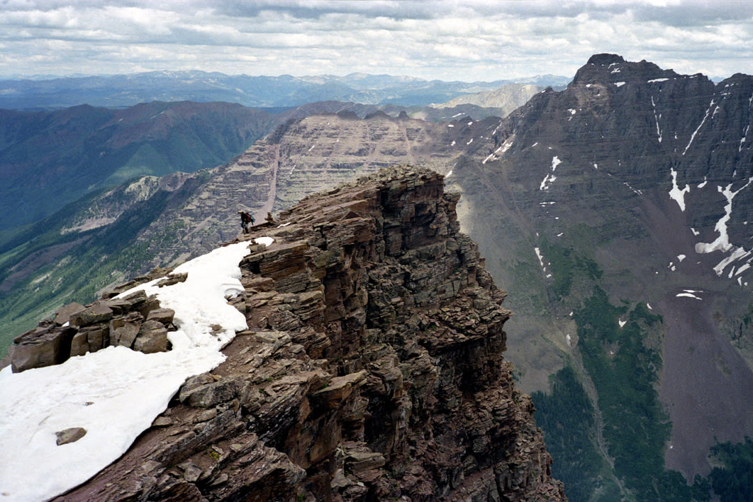
The summit ridge of Snowmass Mountain.
Image: Dan Bayer
Snowmass Mountain
Height: 14,099 ft
Rank among Colorado 14ers: 33
First ascent: Aug 7, 1873, by the Hayden Survey party
Standard route length: 21 miles round-trip
Vertical: 5,100 ft
Difficulty: Class 3
Named for the broad snowfield that coats its eastern flank until well into the summer, Snowmass Mountain is one of Colorado’s most sublime summits. It’s also one of the most remote, hidden deep in the Maroon Bells–Snowmass Wilderness, far from any paved roads. Nearby is a blocky point that your map may label Hagerman Peak. It honors a true Elk Mountain pioneer. Percy Hagerman was a Colorado businessman, philanthropist, and mountaineer credited with first ascents of most of the difficult summits in the Elks. Often, he was accompanied by climbing partner Harold Clark (for whom nearby Clark Peak is named).
In his book Notes on Mountaineering in the Elk Mountains of Colorado, 1908-1910, Hagerman wrote of the area around Snowmass Mountain: “These peaks are among the finest in the Rockies … They have big streams and fine large lakes; they are rugged, steep, and forbidding in appearance; some of them are richly colored; and finally, the upper stretches have not been scarred with mining claims.” Ironically, Hagerman and Clark were not the first to climb Snowmass. It was summited by the Hayden Survey, which mapped out the area and gave the mountain its English name.
First-hand account:
Snowmass took several shots. The first time I tried it was early on, when I weighed more. I also wasn’t being careful about how much my pack weighed, and I couldn’t even finish the hike to the lake, much less the climb. That set a goal that I was going to lose weight. As soon as I got the weight off, all of a sudden everything became possible. A few years later, when I was 70 and my son Brett was 31, he and I and a friend backpacked to Snowmass Lake. I had no trouble with it at my new weight. The climb up the mountain is arduous. It’s not difficult, but you go all the way left to find a place to get up on the ridge, then you come all the way back right toward the summit and get into some Class 3 terrain. The loose rock pulls out easily, and I was still figuring out some of the techniques in rock climbing. My son turned out to be the teacher, coaching me, showing me the route finding and how to climb up the rock without pulling the mountain apart on top of me. It’s that reversal that happens in the life of every family. As the kids grow up, eventually they get to be better than their parents, and Brett is definitely a much better climber than I am. —Rick Crandall, Aspen-based tech CEO and blogger who climbed his first 14er at age 65
Capitol Peak
Height: 14,130 ft
Rank Among Colorado 14ers: 31
First Ascent: Aug 22, 1909, by Harold Clark and Percy Hagerman
Standard Route Length: 17 miles round-trip
Vertical: 5,800 ft
Difficulty: Class 4
From a distance, at just the right angle, Capitol Peak’s distinctive dome slightly resembles its namesake in Washington, DC. Up close, however, from Capitol’s fabled knife-edge ridge, any resemblance between this singular peak and a building ends abruptly. How abruptly? Let’s do the math. After traversing the knife edge, a 100-foot-long section so narrow it comes to a sharp point, climbers often state that the drops off both sides were 2,000 feet or more. The ridge lies at roughly 13,660 feet. To the southeast, the basin containing the four Pierre Lakes sits at some 12,000 feet, a mere 1,660 feet below. To the northwest, Capitol Lake rests below in a bowl of rock at 11,600 feet. Admittedly, that’s 2,060 feet below the knife edge, but a fall off the ridge would result in a series of drops, not a single 2,000-foot plunge. Our advice: keep your hands and feet on the wonderfully solid rock and soak up the energy of one of the most life-affirming spots you’ll ever visit.
First-hand account:
I was guiding two clients on Capitol. While descending from the summit, we encountered five people climbing without ropes. The young man who appeared to be the leader wasn't wearing a helmet. When I asked where his helmet was, he barked back that he’d climbed much harder mountains. My guests and I were paused near the east side of K2 when I heard a rock move. I looked up to see a male in the group of five dislodge a microwave-size block under his feet, then pull an equally large block onto his head and begin falling in a steep gully. I approached the gully expecting to see a dead man, but he was sitting upright, sliding down a 50-degree rock chute. The leader, now with his helmet on, rushed to the scene and was able to move his friend out of the shooting gallery. I called 911 to start the process for a helicopter rescue. Apparently the injured man made a full recovery. The helmet he was wearing saved his life in the fall. I would like to think that the leader guy wears a helmet on 14ers now, too. —Amos Whiting, owner and head guide, Aspen Expeditions
Standard route:
The trailhead is at the end of Capitol Creek Road, which requires a high-clearance vehicle to access; passenger cars can be parked along the road at the foot of a steep hill. Most climbers backpack the 6.5 miles to Capitol Lake, a beautiful tarn beneath the vertical ramparts of the peak’s northwest face. From the lake, a steep climbers trail leads east to the saddle between Capitol and Mount Daly. Then it’s a scramble south across a talus field to access the tiny summit, known as K2, northeast of Capitol. Beyond K2 is the knife edge in all its glory. After this challenge, the route continues along the ridge, then moves left onto the eastern flanks of Capitol’s dome. A series of rock chimneys lead to the awe-inspiring summit.
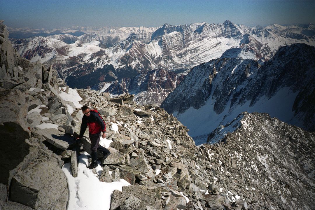
The summit of Mount Elbert.
Image: Dan Bayer
14ers Over the Pass
Beautiful as they are, the Elk Mountain 14ers are a fairly difficult and dangerous bunch, holding less appeal for novice peak baggers. If you consider yourself part of that group but still want to conquer some of Colorado’s loftiest summits, look east to the other side of Independence Pass for this trio of Sawatch Mountain behemoths.
Mount Elbert
14,433 feet
Colorado’s tallest mountain—and the highest point between California’s Mount Whitney and France’s Mont Blanc—is also one of the simplest 14ers to climb, requiring nothing more than a strenuous walk. That also means the standard trail up the northeast ridge (9–11 miles round-trip) is often crowded. For a more sporting and solitary climb, hike the 10-mile round-trip, Class 2 Black Cloud Trail, which leaves from a trailhead off Highway 82 a couple of miles west of Twin Lakes. The trail follows Black Cloud Creek into a secluded valley before crossing 14,134-foot South Elbert on its way to the main summit. Our recommendation: stage a car shuttle and hike up the Black Cloud Trail and down the standard route for a memorable loop.
Mount Massive
14,421 feet
When it comes to sheer bulk and above-treeline acreage, no other mountain in Colorado can hang with this mighty lump—the state’s second-highest peak—rising a few miles southwest of Leadville. The most scenic way to climb it is via a 7.4-mile route leaving from the North Halfmoon Creek trailhead that allows you to notch three of Massive’s summits while walking a long, glorious ridge above 14,000 feet for a good mile or so.
La Plata Peak
14,336 feet
There’s nothing technical or difficult about this ascent, but it will test your lungs and, with a 9-mile round-trip hike and 4,300 feet of elevation gain, your legs.
The hike begins a few miles west of Twin Lakes, at the intersection of Highway 82 and South Fork Lake Creek Road. You’ll start by going steeply south into La Plata Gulch before turning east and switchbacking southeast up an excellent Colorado Fourteeners Initiative Trail to La Plata’s northwest ridge to the summit.
First-hand account:
When my husband, Jay, and I were courting, we were doing a lot of 14ers, and we decided to do La Plata with his boss and the boss’s wife. We’d just summited and saw a little bit of weather coming in, so we started heading down. All of a sudden I started hearing this buzzing noise. I took off my hat, and my hair was sticking straight out, fully charged. Apparently, there was lightning in the area, but no one was charged up but me. I ran over to Jay and said, “Help me!” He responded, “Get away from me! Get under a rock.” I got under a rock and the lightning passed. And, yes, I still married Jay despite him telling me to get away from him when I needed help. —Lauren Maytin, Aspen attorney

At Altitude
Group Autobiography Taps into Aspen Nostalgia


At altitude
Wildwood School Celebrates 50 Years

At Altitude
Aspen Community Table

Call & Response
Meet New Aspen Skiing Company CEO Geoff Buchheister

At Altitude
Lucky Duck
tweet this
A Birding Big Year in a Small Valley

Your Perfect Day
Where to Golf in the Roaring Fork Valley
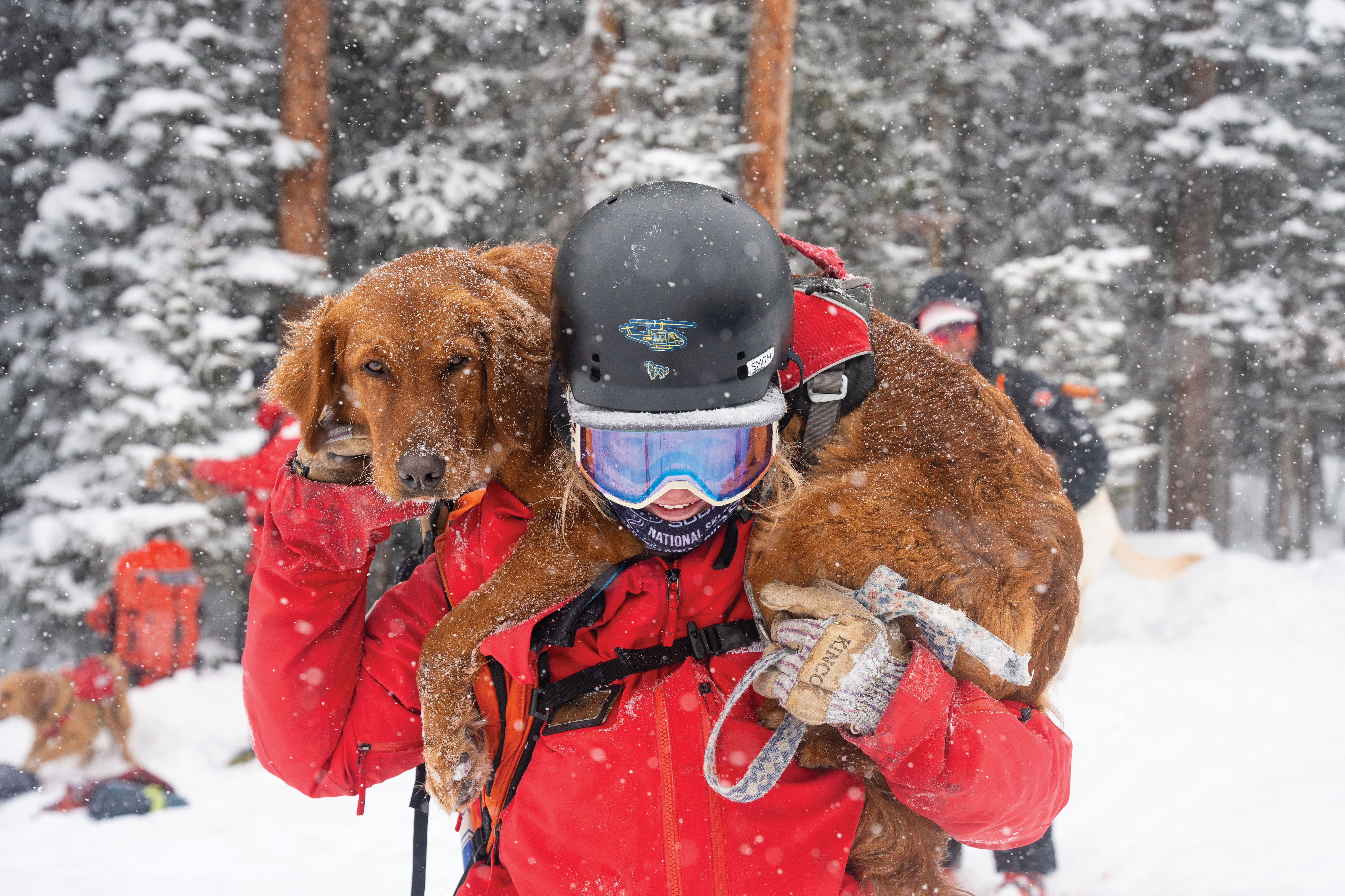
True Heroes
A Day at Dog School

Hero's Welcome
Experience Aspen's Newest High-Altitude Ski Area

Feature
Choose Your Aspen Adventure
At Altitude
Need to Know

Bottle Rocket
Colorado as a Hot Wine Destination?


Restaurant Listings
Aspen Dining Guide

Eat & Drink
Notable Aspen Dining Newcomers

At Altitude
SkiCo's Seven Signature Burgers

Flour Power
Roaring Fork Mill Revives an Ancient Tradition

Arts & Events
Aspen Film Finds New Home

The Art of Gifting
Inspiration Turns Useful at Isa Catto Studio

Arts & Events
Art Base Welcomes Back Reina Katzenberger


Arts
Stage Presence

Arts
Atlas Loved

style roundup
Saddle Up Like an Aspen Cowgirl

Objects of Desire
20/20 Vision
Flour Power
Roaring Fork Mill Revives an Ancient Tradition

At Altitude
Aspen Gift Ideas

Objects of Desire
Aspen Ski Fashion

Objects of Desire
Wild Styled in Aspen


rescue remedy
A Skin Care Must: Antedotum's New Face Oil

Bust a move
Aspen Fitness Three Ways


At Altitude
No Phone Zone

At Altitude
Kick and Glide
At Altitude
Slam Dink

A Night to Inspire
Ascendigo Blue Aspen 2020

People & Places
ASPENX Beach Club with Gray Malin

People & Places
Eighth Annual Action in Africa Winter Fundraiser

People & Places
Audi FIS Ski World Cup in Aspen

People & Places